Blackburn Way
Blackburn Way is a bus stop in Godalming, Waverley District, England. Blackburn Way is situated nearby to Farncombe Boat House, as well as near the church Meadrow Unitarian Chapel.| Tap on a place to explore it |
Places of Interest Nearby
Highlights include Meadrow Unitarian Chapel and Farncombe railway station.
Meadrow Unitarian Chapel
Church

Photo: Hassocks5489, CC0.
Meadrow Unitarian Chapel is a Unitarian chapel in the Farncombe area of Godalming, Surrey, England. It is part of the London District and South Eastern Provincial Assembly of Unitarian and Free Christian Churches, one of 16 districts within the General Assembly of Unitarian and Free Christian Churches, the umbrella organisation for British Unitarians. Meadrow Unitarian Chapel is situated 970 feet north of Blackburn Way.
Farncombe railway station
Railway station

Photo: Bashereyre, Public domain.
Farncombe railway station opened in 1897 as a minor stop on the Portsmouth Direct Line between Guildford and Godalming, England. It is said to have been built at the instigation of General Sir Frederick Marshall, a director of the London and South Western Railway Company, who lived nearby at Broadwater. Farncombe railway station is situated 2,800 feet northwest of Blackburn Way.
St John the Evangelist Church
Church

Photo: Michael FORD, CC BY-SA 2.0.
St John the Evangelist Church is situated 2,400 feet northwest of Blackburn Way.
Places in the Area
Nearby places include Farncombe and Shalford.
Farncombe
Suburb

Photo: Wikimedia, CC BY-SA 2.0.
Farncombe, historically Fernecome, is a village and peripheral settlement of Godalming in Waverley, Surrey, England and is approximately 0.8 miles north-east of the Godalming centre, separated by common land known as the Lammas Lands.
Shalford
Village
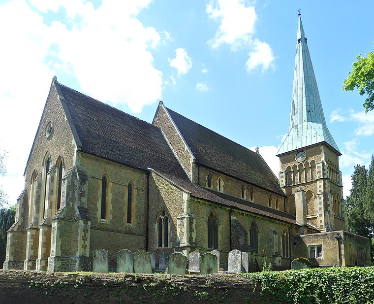
Photo: Hassocks5489, CC0.
Shalford is a village and civil parish in the Guildford district, in Surrey, England on the A281 Horsham road immediately south of Guildford. It has a railway station which is between Guildford and Dorking on the Reading to Gatwick Airport line. Shalford is situated 2 miles northeast of Blackburn Way.
Compton
Village

Photo: Ainslie, CC BY-SA 3.0.
Compton is a village and civil parish in the Guildford district of Surrey, England. It is about 3 miles WSW of the centre of Guildford. It has a medieval church and a close connection with fine art and pottery: it was the later life home of artist George Frederic Watts. Compton is situated 2 miles northwest of Blackburn Way.
Blackburn Way
- Type: Bus stop
- Category: transportation
- Location: Godalming, Waverley District, Surrey, South East England, England, United Kingdom, Britain and Ireland, Europe
- View on OpenStreetMap
Latitude
51.19093° or 51° 11′ 27″ northLongitude
-0.59688° or 0° 35′ 49″ westOpen location code
9C3X5CR3+96OpenStreetMap ID
node 4825743826OpenStreetMap feature
highway=bus_stopOpenStreetMap feature
public_transport=platform
This page is based on OpenStreetMap, Wikidata, and Wikimedia Commons.
We’d love your help improving our open data sources. Thank you for contributing.
Satellite Map
Discover Blackburn Way from above in high-definition satellite imagery.
Notable Places Nearby
Highlights include Farncombe Boat House and Riverside.
Nearby Places
Explore places such as Kamsons Pharmacy and Blackburn Way.
Surrey: Must-Visit Destinations
Delve into Guildford, Woking, Epsom, and Weybridge.
Curious Bus Stops to Discover
Uncover intriguing bus stops from every corner of the globe.
About Mapcarta. Data © OpenStreetMap contributors and available under the Open Database License". Text is available under the CC BY-SA 4.0 license, except for photos, directions, and the map. Photo: Simon Burchell, CC BY-SA 3.0.