Kastelenring
Kastelenring is a tram stop in Leidschendam-Voorburg, Rotterdam-The Hague Metropolitan Region, South Holland. Kastelenring is situated nearby to the community center De Poort, as well as near the health club A Better Me.| Tap on a place to explore it |
Places of Interest Nearby
Highlights include Duivenvoordse en Veenzijdse Polder and HMC Antoniushove.
Duivenvoordse en Veenzijdse Polder
Nature reserve

Photo: Takeaway, CC BY-SA 4.0.
Duivenvoordse en Veenzijdse Polder is a nature reserve.
HMC Antoniushove
Hospital

Photo: WKZH4B, CC BY-SA 3.0.
HMC Antoniushove is a hospital, which is situated 1 km southwest of Kastelenring.
Westfield Mall of the Netherlands
Shopping center
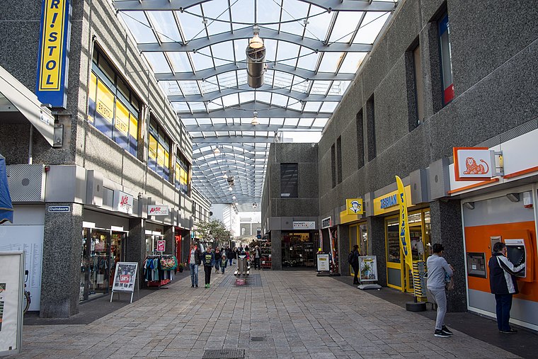
Photo: Takeaway, CC BY-SA 4.0.
Westfield Mall of the Netherlands is a shopping mall located in Leidschendam in the Netherlands. With a total retail floor area of 117,000 m2 it is the largest shopping mall in the Netherlands. Westfield Mall of the Netherlands is situated 1¼ km southwest of Kastelenring.
Places in the Area
Nearby places include Leidschendam and Voorburg.
Leidschendam
Town

Photo: Wikimedia, CC BY-SA 4.0.
Leidschendam is a town and former municipality in the province of South Holland of the Netherlands. Along with Voorburg and Stompwijk, it is part of the municipality Leidschendam-Voorburg.
Voorburg
Town

Photo: Wikimedia, CC BY-SA 3.0.
Voorburg is a town and former municipality in the west part of the province of South Holland, Netherlands. Together with the town Leidschendam and the village Stompwijk, it merged into the municipality of Leidschendam-Voorburg in 2002. Voorburg is situated 4 km southwest of Kastelenring.
Bezuidenhout
Quarter
Bezuidenhout is the neighbourhood southeast of the Haagse Bos district of The Hague in the Netherlands. Bezuidenhout includes the Beatrixkwartier financial area near the Central Station and streets such as Bezuidenhoutseweg, Juliana van Stolberglaan, Laan van Nieuw Oost-Indië, Prins Clauslaan, and Theresiastraat. Bezuidenhout is situated 4 km west of Kastelenring.
Kastelenring
- Type: Tram stop
- Categories: railway stop, transport stop, and transportation
- Location: Leidschendam-Voorburg, Rotterdam-The Hague Metropolitan Region, South Holland, Western Netherlands, Netherlands, Benelux, Europe
- View on OpenStreetMap
Latitude
52.09758° or 52° 5′ 51″ northLongitude
4.39449° or 4° 23′ 40″ eastOperator
HTM PersonenvervoerNetwork
Rail Haaglanden ConcessionOpen location code
9F4639XV+2QOpenStreetMap ID
node 496283352OpenStreetMap feature
public_transport=stop_positionOpenStreetMap feature
railway=tram_stop
This page is based on OpenStreetMap, Wikidata, and Wikimedia Commons.
We’d love your help improving our open data sources. Thank you for contributing.
Satellite Map
Discover Kastelenring from above in high-definition satellite imagery.
Places with the Same Name
Discover other places named “Kastelenring”.
Notable Places Nearby
Highlights include A Better Me and De Poort.
Nearby Places
Explore places such as Multi Fysio Leidschendam Duivenvoorde and Multi Fysio Leidschendam Frisolaan.
Rotterdam-The Hague Metropolitan Region: Must-Visit Destinations
Delve into Rotterdam, The Hague, Delft, and Zoetermeer.
Curious Tram Stops to Discover
Uncover intriguing tram stops from every corner of the globe.
About Mapcarta. Data © OpenStreetMap contributors and available under the Open Database License". Text is available under the CC BY-SA 4.0 license, except for photos, directions, and the map. Photo: Takeaway, CC BY-SA 4.0.