Vinnies Milton
Vinnies Milton is a second-hand shop in Brisbane, Queensland. Vinnies Milton is situated nearby to Milton Park, as well as near Nerida Lane Park.| Tap on a place to explore it |
- Opening hours: Tuesday—Saturday 10:00 AM—4:00 PM
- Type: Second-hand shop
- Wheelchair access: no
Places of Interest Nearby
Highlights include Lang Park and Milton railway station.
Lang Park
Stadium
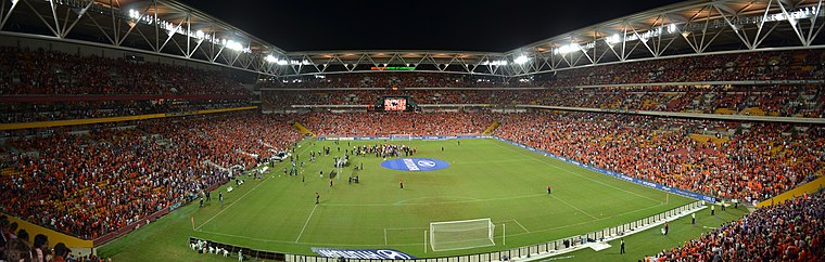 Brisbane Stadium, currently known as Suncorp Stadium for sponsorship reasons, is a multi-purpose stadium in the suburb of Milton, Brisbane, Queensland, Australia. Lang Park is situated 1 km northeast of Vinnies Milton.
Milton railway station
Railway station

Photo: TravellerQLD, CC BY-SA 3.0.
Milton railway station is located on the Main line in Queensland, Australia. It serves the Brisbane suburb of Milton. The station includes a walkbridge to Lang Park and is also immediately adjacent the Castlemaine Perkins brewery. Milton railway station is situated 460 metres northeast of Vinnies Milton.
Wesley Hospital
Hospital

Photo: Commander Keane, Public domain.
The Wesley Hospital is a private hospital located in the suburb of Auchenflower in Brisbane, Queensland, Australia. The hospital currently has over 530 beds and offers a large range of clinical services. Wesley Hospital is situated 780 metres southwest of Vinnies Milton.
Places in the Area
Nearby places include West End and Red Hill.
West End
Suburb

Photo: Misaochan2, CC BY 4.0.
West End is an inner southern suburb in the City of Brisbane, Queensland, Australia. In the 2021 census, West End had a population of 14,730 people. The Aboriginal name for the area is Kurilpa, which means place of the water rat.
Red Hill
Suburb
Red Hill is an inner northern suburb in the City of Brisbane, Queensland, Australia. In the 2021 census, Red Hill had a population of 5,834 people.
South Bank
Neighborhood

Photo: willislim, CC BY-SA 2.0.
South Bank is a cultural, social, educational and recreational precinct in Brisbane, Queensland, Australia. The precinct is located in the suburb of South Brisbane, on the southern bank of the Brisbane River.
Vinnies Milton
- Category: shop
- Location: Brisbane, Queensland, Australia, Oceania
- View on OpenStreetMap
Latitude
-27.47195° or 27° 28′ 19″ southLongitude
153.002° or 153° 0′ 7″ eastOpen location code
5R4MG2H2+6ROpenStreetMap ID
node 4987667013OpenStreetMap feature
shop=second_handOpenStreetMap attribute
wheelchair=no
This page is based on OpenStreetMap, Wikidata, and Wikimedia Commons.
We’d love your help improving our open data sources. Thank you for contributing.
Satellite Map
Discover Vinnies Milton from above in high-definition satellite imagery.
Notable Places Nearby
Highlights include Milton Park and Nerida Lane Park.
Nearby Places
Explore places such as Pallermo and Wildfire Sports & Trek.
Queensland: Must-Visit Destinations
Delve into Brisbane, Gold Coast, Sunshine Coast, and Cairns.
Curious Second-Hand Shops to Discover
Uncover intriguing second-hand shops from every corner of the globe.
About Mapcarta. Data © OpenStreetMap contributors and available under the Open Database License". Text is available under the CC BY-SA 4.0 license, except for photos, directions, and the map. Photo: Wikimedia, CC0.