Unidad Habitacional Culhuacán STUNAM
Unidad Habitacional Culhuacán STUNAM is a neighborhood in Mexico City, Central Mexico. Unidad Habitacional Culhuacán STUNAM is situated nearby to the neighborhood Ex Ejido de San Francisco Culhuacán, as well as near Colonia La Virgen 1170.| Tap on a place to explore it |
Places of Interest
Highlights include Lomas Estrella metro station and San Andrés Tomatlán metro station.
Lomas Estrella metro station
Metro station

Photo: GAED, CC BY-SA 3.0.
Lomas Estrella is a station on Line 12 of the Mexico City Metro. The station is located between San Andrés Tomatlán and Calle 11. It was opened on 30 October 2012 as a part of the first stretch of Line 12 between Mixcoac and Tláhuac.
San Andrés Tomatlán metro station
Metro station
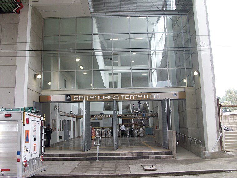
Photo: GAED, CC BY-SA 3.0.
San Andrés Tomatlán is a station on Line 12 of the Mexico City Metro. The station is located between Culhuacán and Lomas Estrella. It was opened on 30 October 2012 as a part of the first stretch of Line 12 between Mixcoac and Tláhuac.
Universidad Autónoma Metropolitana Unidad Xochimilco
University

Photo: Wikimedia, CC BY-SA 4.0.
Universidad Autónoma Metropolitana Unidad Xochimilco is an university.
Places in the Area
Nearby places include Pueblo Culhuacán and Iztapalapa.
Pueblo Culhuacán
Quarter

Photo: Thelmadatter, CC BY-SA 3.0.
Pueblo Culhuacán is an officially designated neighborhood of the Iztapalapa borough of Mexico City, which used to be a major pre-Hispanic city. Ancient Culhuacán was founded around 600 CE and the site has been continuously occupied since.
Iztapalapa

Photo: Pancho Cárdenas, CC BY-SA 3.0.
Iztapalapa is in the eastern part of Mexico City. It is a rough and tumble area that is the most populous borough in the city, as well as the poorest, and most crime-ridden.
Colonia de La Candelaria
Quarter

Photo: Betoqa, CC BY-SA 3.0.
Colonia de La Candelaria is a quarter, which is situated 5 km west of Unidad Habitacional Culhuacán STUNAM.
Unidad Habitacional Culhuacán STUNAM
- Type: Neighborhood
- Postal code: 04908
- Category: locality
- Location: Mexico City, Central Mexico, Mexico, North America
- View on OpenStreetMap
Latitude
19.32103° or 19° 19′ 16″ northLongitude
-99.10213° or 99° 6′ 8″ westOpen location code
76F28VCX+C4OpenStreetMap ID
node 5039653812OpenStreetMap feature
place=neighbourhood
This page is based on OpenStreetMap, Wikidata, and Wikimedia Commons.
We’d love your help improving our open data sources. Thank you for contributing.
Satellite Map
Discover Unidad Habitacional Culhuacán STUNAM from above in high-definition satellite imagery.
Localities in the Area
Explore places such as Ex Ejido de San Francisco Culhuacán and Colonia La Virgen 1170.
Notable Places Nearby
Highlights include Coordinación Territorial COY-5 (PGJDF Y SSP) and Casa de la Cultura Ricardo Flores Magón.
Mexico City: Must-Visit Destinations
Delve into Centro, Xochimilco, Coyoacán, and Condesa and Roma.
Curious Neighborhoods to Discover
Uncover intriguing neighborhoods from every corner of the globe.
About Mapcarta. Data © OpenStreetMap contributors and available under the Open Database License". Text is available under the CC BY-SA 4.0 license, except for photos, directions, and the map. Photo: Wikimedia, CC BY 2.0.