Duvelorium
Duvelorium is a bar in Bruges, West Flanders, Flanders. Duvelorium is situated nearby to the museum Historium Bruges, as well as near the building Provinciaal Hof.| Tap on a place to explore it |
Places of Interest Nearby
Highlights include Belfry and Historium Bruges.
Belfry

Photo: Jean-Pol GRANDMONT, CC BY-SA 4.0.
The Belfry of Bruges is a medieval bell tower in the centre of Bruges, Belgium. One of the city's most prominent symbols, the belfry formerly housed a treasury and the municipal archives and served as an observation post for spotting fires and other dangers. Belfry is situated 110 metres south of Duvelorium.

City Hall
Town hall
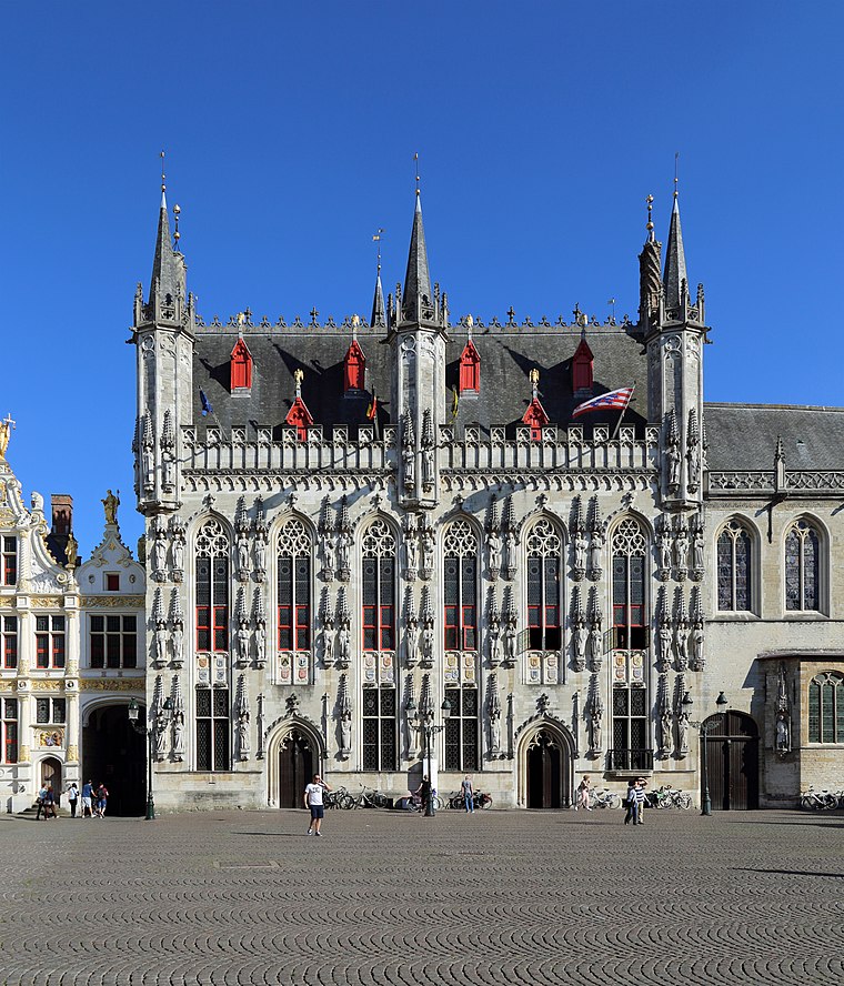
Photo: MJJR, CC BY-SA 4.0.
The City Hall of Bruges, West Flanders, Belgium, is a landmark building and the seat of that city. Built in a late-Gothic monumental style between 1376 and 1421, it is one of the oldest city halls in the former Burgundian Netherlands. City Hall is situated 200 metres southeast of Duvelorium.
Places in the Area
Nearby places include Ezelstraatkwartier and Sint-Gillis.


Duvelorium
- Type: Bar
- Wheelchair access: yes
- Location: Bruges, Arrondissement of Bruges, West Flanders, Flanders, Belgium, Benelux, Europe
- View on OpenStreetMap
Latitude
51.20921° or 51° 12′ 33″ northLongitude
3.2249° or 3° 13′ 30″ eastOpen location code
9F35665F+MXOpenStreetMap ID
node 5105482621OpenStreetMap feature
amenity=barOpenStreetMap attribute
wheelchair=yes
This page is based on OpenStreetMap, Wikidata, and Wikimedia Commons.
We’d love your help improving our open data sources. Thank you for contributing.
Satellite Map
Discover Duvelorium from above in high-definition satellite imagery.
Notable Places Nearby
Highlights include Provinciaal Hof and Monument to Jan Breydel and Pieter de Coninck.
Nearby Places
Explore places such as Carrefour Express and Hofshop.
West Flanders: Must-Visit Destinations
Delve into Kortrijk, Ostend, Ypres, and Roeselare.
Curious Bars to Discover
Uncover intriguing bars from every corner of the globe.
About Mapcarta. Data © OpenStreetMap contributors and available under the Open Database License". Text is available under the CC BY-SA 4.0 license, except for photos, directions, and the map. Photo: MJJR, CC BY 3.0.