Esch, Cité Jos Brebsom
Esch, Cité Jos Brebsom is a bus stop in Esch-sur-Alzette, Luxembourg. Esch, Cité Jos Brebsom is situated nearby to the bridge Viaduc, as well as near Saint Henri Church of Esch-sur-Alzette.| Tap on a place to explore it |
Places of Interest Nearby
Highlights include Rockhal and Saint Henri Church of Esch-sur-Alzette.
Rockhal
Theater building

Photo: Cornischong, CC BY-SA 1.0.
The Rockhal, officially Centre de Musiques Amplifiées, is a concert hall in Esch-sur-Alzette, in southern Luxembourg. It opened on 23 September 2005, has a maximum capacity of 6,500 people and is sited on the former industrial site of Belval in the west of Esch. Rockhal is situated 1¼ km west of Esch, Cité Jos Brebsom.
Saint Henri Church of Esch-sur-Alzette
Church
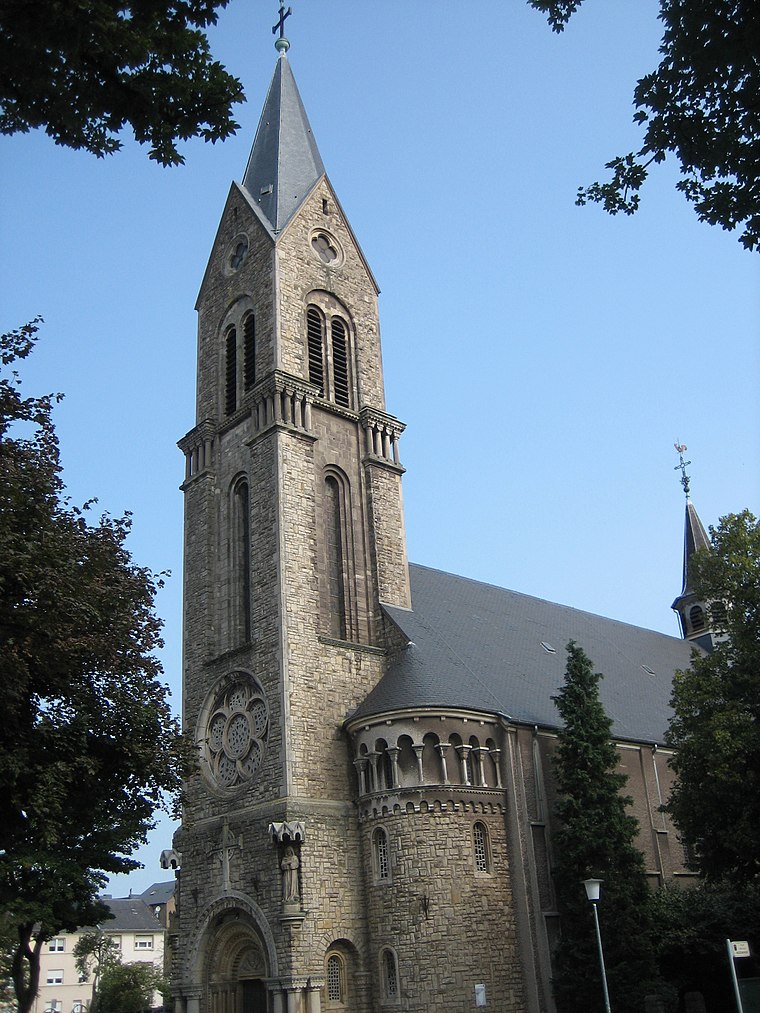
Photo: Zinneke, CC BY-SA 3.0.
Saint Henri Church of Esch-sur-Alzette is situated 690 metres east of Esch, Cité Jos Brebsom.
National Resistance Museum, Luxembourg
Museum

Photo: Cayambe, CC BY-SA 4.0.
The National Museum of Resistance and Human Rights is located in the centre of Esch-sur-Alzette in the south-west of Luxembourg. The specially designed building traces the history of Luxembourg from 1940 to 1945 under the Nazi oppression, through the reactions of the people, until liberation, by photos, objects and works of art. National Resistance Museum, Luxembourg is situated 1¼ km southeast of Esch, Cité Jos Brebsom.
Places in the Area
Nearby places include Esch-sur-Alzette and Land of the Red Rocks.
Esch-sur-Alzette
Town

Photo: Zinneke, CC BY-SA 4.0.
The Land of the Red Rocks, also known as the Esch-sur-Alzette canton, is the southwestmost region of Luxembourg.
Land of the Red Rocks
The Land of the Red Rocks, also known as the Esch-sur-Alzette canton, is the southwestmost region of Luxembourg.Ehlerange
Village

Photo: Pecalux, CC BY-SA 3.0 lu.
Ehlerange is a small town in the commune of Sanem, in south-western Luxembourg. As of 2024, the town has a population of 983.
Esch, Cité Jos Brebsom
- Type: Bus stop
- Category: transportation
- Location: Esch-sur-Alzette, Luxembourg, Benelux, Europe
- View on OpenStreetMap
Latitude
49.50192° or 49° 30′ 7″ northLongitude
5.96562° or 5° 57′ 56″ eastOpen location code
8FX7GX28+Q6OpenStreetMap ID
node 5139054120OpenStreetMap feature
highway=bus_stopOpenStreetMap feature
public_transport=platform
This page is based on OpenStreetMap, Wikidata, and Wikimedia Commons.
We’d love your help improving our open data sources. Thank you for contributing.
Satellite Map
Discover Esch, Cité Jos Brebsom from above in high-definition satellite imagery.
Notable Places Nearby
Highlights include Viaduc and Place de Stalingrad.
Nearby Places
Explore places such as Esch, Cité Jos Brebsom and Esch, Rue Marie Muller-Tesch.
Luxembourg: Must-Visit Destinations
Delve into Luxembourg, Central Luxembourg, Schengen, and Echternach.
Curious Bus Stops to Discover
Uncover intriguing bus stops from every corner of the globe.
About Mapcarta. Data © OpenStreetMap contributors and available under the Open Database License". Text is available under the CC BY-SA 4.0 license, except for photos, directions, and the map. Photo: Michal Osmenda, CC BY-SA 2.0.