Södertälje Båtklubb
Södertälje Båtklubb is a marina in Södertälje socken, Västertälje, Stockholm County. Södertälje Båtklubb is situated nearby to the islet Sällskapsholmen, as well as near Krutholmen.| Tap on a place to explore it |
Places of Interest Nearby
Highlights include Lina Church and Tom Tits Experiment.
Lina Church
Church

Photo: Nordelch, CC BY-SA 3.0.
Lina Church is situated 640 metres northwest of Södertälje Båtklubb.
Tom Tits Experiment
Museum
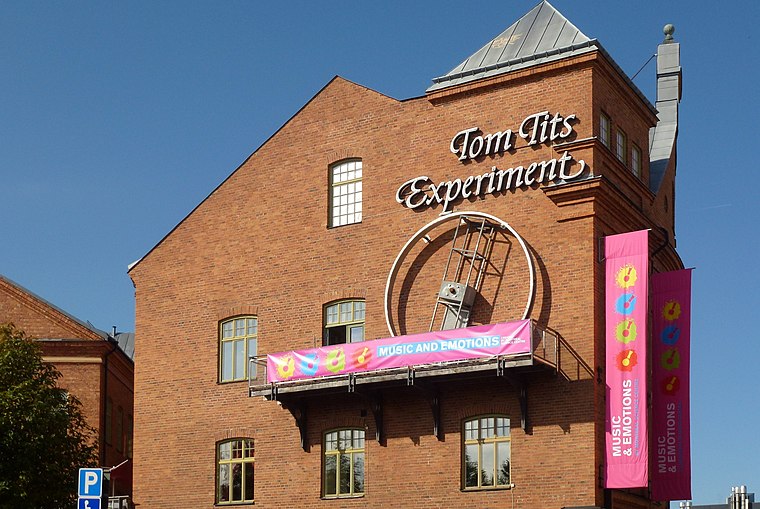
Photo: Holger.Ellgaard, CC BY-SA 3.0.
Tom Tits Experiment is a science centre and preschool located in the municipality of Södertälje in Stockholm County, Sweden. It calls itself "Swedens first and largest science centre". The centre opened in 1987, with the preschool opening in 2004. Tom Tits Experiment is situated 1 km southeast of Södertälje Båtklubb.
Bårsta IP
Sports venue
Bårsta IP is a stadium in Södertälje, Sweden. The stadium is best known for having been the stadium of football club Assyriska until late 2005. It was the club's home stadium during their sole season in Sweden's top football division Allsvenskan in 2005. Bårsta IP is situated 1 km southwest of Södertälje Båtklubb.
Places in the Area
Nearby places include Södertälje and Hovsjö.
Södertälje

Photo: Holger.Ellgaard, CC BY-SA 4.0.
Södertälje, is a city in the province of Södermanland and Stockholm County in Sweden. Many visit the city for attractions like the science centre Tom Tits and the open air museum Torekällberget.
Hovsjö
Suburb
Hovsjö is a neighborhood in the city of Södertälje in Stockholm County, Sweden. Hovsjö is situated 3½ km south of Södertälje Båtklubb.
Ekeby
Village

Photo: Sapfan, Public domain.
Ekeby is a locality situated in Södertälje Municipality, Stockholm County, Sweden with 1,018 inhabitants in 2010. Ekeby is situated 7 km northwest of Södertälje Båtklubb.
Södertälje Båtklubb
- Type: Marina
- Categories: recreation area and transportation
- Location: Södertälje socken, Västertälje, Södertälje Municipality, Stockholm County, Svealand, Sweden, Nordic countries, Europe
- View on OpenStreetMap
Latitude
59.20856° or 59° 12′ 31″ northLongitude
17.61229° or 17° 36′ 44″ eastOpen location code
9FFV6J56+CWOpenStreetMap ID
node 5189419744OpenStreetMap feature
leisure=marina
This page is based on OpenStreetMap, Wikidata, and Wikimedia Commons.
We’d love your help improving our open data sources. Thank you for contributing.
Satellite Map
Discover Södertälje Båtklubb from above in high-definition satellite imagery.
Notable Places Nearby
Highlights include Sällskapsholmen and Krutholmen.
Nearby Places
Explore places such as Building 322 and Törnrosavägen.
Stockholm County: Must-Visit Destinations
Delve into Stockholm, Södermalm, Södertälje, and Norrmalm.
Curious Marinas to Discover
Uncover intriguing marinas from every corner of the globe.
About Mapcarta. Data © OpenStreetMap contributors and available under the Open Database License". Text is available under the CC BY-SA 4.0 license, except for photos, directions, and the map. Photo: Smiley.toerist, CC BY-SA 4.0.