Belle Scarpe+
Belle Scarpe+ is a shoe store in Peer, Arrondissement of Maaseik, Flanders. Belle Scarpe+ is situated nearby to the post office Postkantoor, as well as near the church Sint-Trudokerk.| Tap on a place to explore it |
Places of Interest Nearby
Highlights include Sint-Trudokerk and Snow Valley.

Snow Valley
Sports venue

Photo: Wikimedia, Public domain.
Snow Valley is a sports venue, which is situated 1½ km southeast of Belle Scarpe+.
Kleine Brogel Air Base
Aerodrome
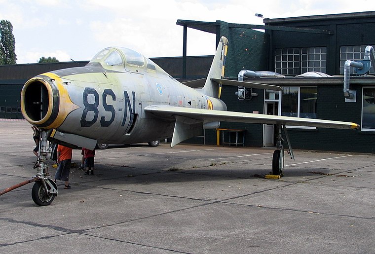
Photo: Paul Hermans, CC BY-SA 3.0.
Kleine Brogel Air Base is a Belgian Air Component military airfield located 0.8 nautical miles east of Kleine-Brogel, in the municipality of Peer, Belgium. Kleine Brogel Air Base is situated 4 km north of Belle Scarpe+.
Places in the Area
Nearby places include Wijchmaal and Eksel.
Wijchmaal
Village
Wijchmaal is a village in the province of Limburg, Belgium, which since 1977 has been a subdivision of the municipality of Peer. It is located on the low Kempen plateau and has predominantly sandy soil. Wijchmaal is situated 2½ km west of Belle Scarpe+.
Eksel
Village

Photo: Sonuwe, CC BY-SA 3.0.
Eksel is a village, which is situated 4½ km northwest of Belle Scarpe+.
Hechtel-Eksel
Town

Photo: Sonuwe, CC BY-SA 3.0.
Hechtel-Eksel is a municipality located in the Belgian province of Limburg. On 1 January 2018 it had a total population of 12,290 an area of 76.70 km. The municipality was created in January 1977 as a merger of the two former municipalities Hechtel and Eksel. Hechtel-Eksel is situated 5 km west of Belle Scarpe+.
Belle Scarpe+
- Opening hours:
Tuesday—Friday: 10:00 AM—noon and 1:30 PM—6:00 PM
Saturday: 10:00 AM—5:00 PM - Type: Shoe store
- Category: shop
- Location: Peer, Arrondissement of Maaseik, Limburg, Flanders, Belgium, Benelux, Europe
- View on OpenStreetMap
Latitude
51.13312° or 51° 7′ 59″ northLongitude
5.45121° or 5° 27′ 4″ eastOpen location code
9F374FM2+6FOpenStreetMap ID
node 5190646413OpenStreetMap feature
shop=shoes
This page is based on OpenStreetMap, Wikidata, and Wikimedia Commons.
We’d love your help improving our open data sources. Thank you for contributing.
Satellite Map
Discover Belle Scarpe+ from above in high-definition satellite imagery.
Notable Places Nearby
Highlights include Postkantoor and Harmoniezaal.
Nearby Places
Explore places such as Hendrix and Feestzaal ‘t Kabinet.
Limburg: Must-Visit Destinations
Delve into Sint-Truiden, Hasselt, Tongeren, and Genk.
Curious Shoe Stores to Discover
Uncover intriguing shoe stores from every corner of the globe.
About Mapcarta. Data © OpenStreetMap contributors and available under the Open Database License". Text is available under the CC BY-SA 4.0 license, except for photos, directions, and the map. Photo: Wikimedia, CC BY 4.0.