Iglesia De Dios
Iglesia De Dios is a place of worship in Antonio Nariño, Bogotá D.C., Bogotá which is located on Carrera 8. Iglesia De Dios is situated nearby to the military installation Batallon de Mantenimiento José María Rosillo, as well as near the hospital CAP San Cristóbal.| Tap on a place to explore it |
Places of Interest Nearby
Highlights include Parroquia del Divino Niño and Gold Museum.
Parroquia del Divino Niño

Photo: Mavelus, CC BY-SA 3.0.
Parroquia del Divino Niño is situated 1 km southwest of Iglesia De Dios.
Gold Museum
Museum
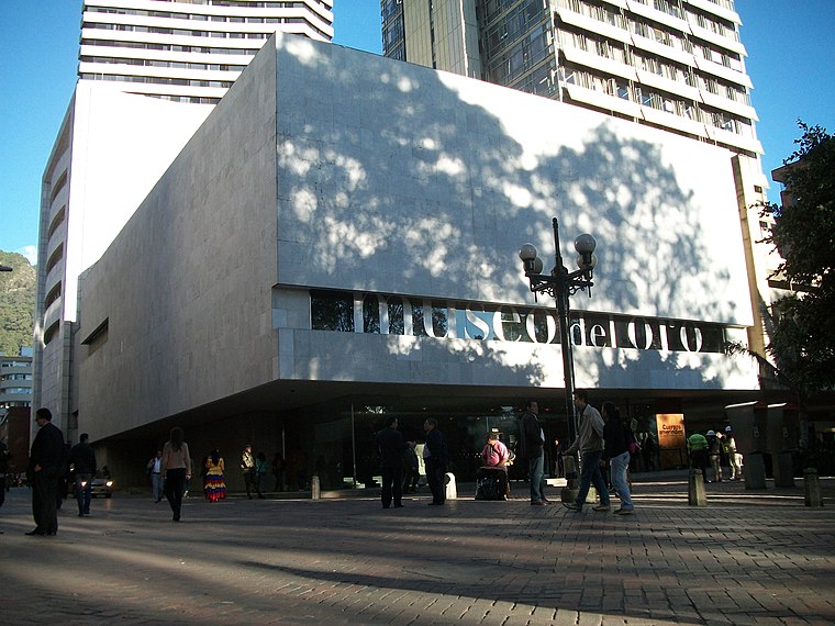
Photo: Pedro Felipe, CC BY-SA 3.0.
The Museum of Gold is an archaeology museum located in Bogotá, Colombia. It is one of the most visited touristic highlights in the country. The museum receives around 500,000 tourists per year. Gold Museum is situated 3½ km northeast of Iglesia De Dios.
Casa de Nariño
Government office

Photo: Juanjo70000, CC BY-SA 4.0.
The Casa de Nariño, literally the House of Nariño, is the official residence and principal workplace of the President of Colombia. It houses the main office of the executive branch and is located in the capital city of Bogotá, Colombia. Casa de Nariño is situated 3 km northeast of Iglesia De Dios.
Places in the Area
Nearby places include Veinte de Julio and South Bogotá.
South Bogotá

Photo: Pedro Felipe, CC BY-SA 3.0.
The South is a large area comprising six localities of Bogota. This area tends to be where the majority of the city's low-income and middle-working classes live.
San Cristóbal
Suburb

Photo: EEIM, CC BY-SA 3.0.
San Cristóbal, also known as San Cristóbal Sur to distinguish it from a neighborhood in Usaquén, is the fourth locality of Bogotá, capital of Colombia. It is located in the southeast of Bogota. This district is mostly inhabited by lower class residents.
Iglesia De Dios
- Type: Place of worship
- Address: 18-61 Carrera 8
- Category: religion
- Location: Antonio Nariño, Bogotá D.C., Bogotá, Andino, Colombia, South America
- View on OpenStreetMap
Latitude
4.5752° or 4° 34′ 31″ northLongitude
-74.09229° or 74° 5′ 32″ westOpen location code
67P7HWG5+33OpenStreetMap ID
node 5208892372OpenStreetMap feature
amenity=place_of_worship
This page is based on OpenStreetMap, Wikidata, and Wikimedia Commons.
We’d love your help improving our open data sources. Thank you for contributing.
Satellite Map
Discover Iglesia De Dios from above in high-definition satellite imagery.
Places with the Same Name
Discover other places named “Iglesia De Dios”.
Notable Places Nearby
Highlights include Batallon de Mantenimiento José María Rosillo and CAP San Cristóbal.
Nearby Places
Explore places such as Distribuidora Global Plast and Comunitel.
Bogotá: Must-Visit Destinations
Delve into La Candelaria, Zona Rosa, Santa Fé-Los Mártires, and Usaquén.
Curious Place Of Worships to Discover
Uncover intriguing place of worships from every corner of the globe.
About Mapcarta. Data © OpenStreetMap contributors and available under the Open Database License". Text is available under the CC BY-SA 4.0 license, except for photos, directions, and the map. Photo: Wikimedia, CC BY-SA 3.0.