Service des Transports Maritimes
Service des Transports Maritimes is a government office in Dzaoudzi, Mayotte. Service des Transports Maritimes is situated nearby to the government office Affaires Maritimes, as well as near the police station Gendarmerie.| Tap on a place to explore it |
Places of Interest Nearby
Highlights include Musée de Mayotte and St. Michael’s Church, Dzaoudzi.
Musée de Mayotte
Museum

Photo: Jean-Pierre Dalbéra, CC BY 2.0.
Musée de Mayotte is a museum, which is situated 620 metres northwest of Service des Transports Maritimes.
St. Michael’s Church, Dzaoudzi
Church

Photo: Jean-Pierre Dalbéra, CC BY 2.0.
The St. Michael's Church or simply the Church of Dzaoudzi, is a religious building belonging to the Catholic Church and is located in the town of Dzaoudzi in the French overseas department of Mayotte, in the Indian Ocean. St. Michael’s Church, Dzaoudzi is situated 1 km northwest of Service des Transports Maritimes.
Dzaoudzi Pamandzi International Airport
Aerodrome

Photo: mwanasimba, CC BY-SA 2.0.
Dzaoudzi–Pamandzi International Airport is an airport located in Pamandzi, Mayotte, France on the southern tip of the island of Petite-Terre, east of Grande-Terre, the main island of Mayotte. Dzaoudzi Pamandzi International Airport is situated 3½ km southeast of Service des Transports Maritimes.
Places in the Area
Nearby places include Dzaoudzi and Labattoir.
Dzaoudzi
Town
 Dzaoudzi is a commune in the French overseas department of Mayotte, in the Indian Ocean. The commune of Dzaoudzi, made up of the twin towns of Dzaoudzi and Labattoir, is located on the small island of Petite-Terre.
Labattoir
Village
Labattoir is a village in the commune of Dzaoudzi on Mayotte, about 4,998 mi south of Paris, the country's capital.
Mamoudzou

Photo: Julien.noel, Public domain.
Mamoudzou is the chief town in Mayotte, with a population of 71,437 in 2017. It's on the main island, Grande-Terre, looking across a 2 km channel to the other island, Petite-Terre, which has the airport.
Service des Transports Maritimes
- Type: Government office
- Categories: office and government building
- Location: Dzaoudzi, Mayotte, East African Islands, Africa
- View on OpenStreetMap
Latitude
-12.78598° or 12° 47′ 10″ southLongitude
45.26087° or 45° 15′ 39″ eastOpen location code
5HV76776+J8OpenStreetMap ID
node 5306645870OpenStreetMap feature
office=government
This page is based on OpenStreetMap, Wikidata, and Wikimedia Commons.
We’d love your help improving our open data sources. Thank you for contributing.
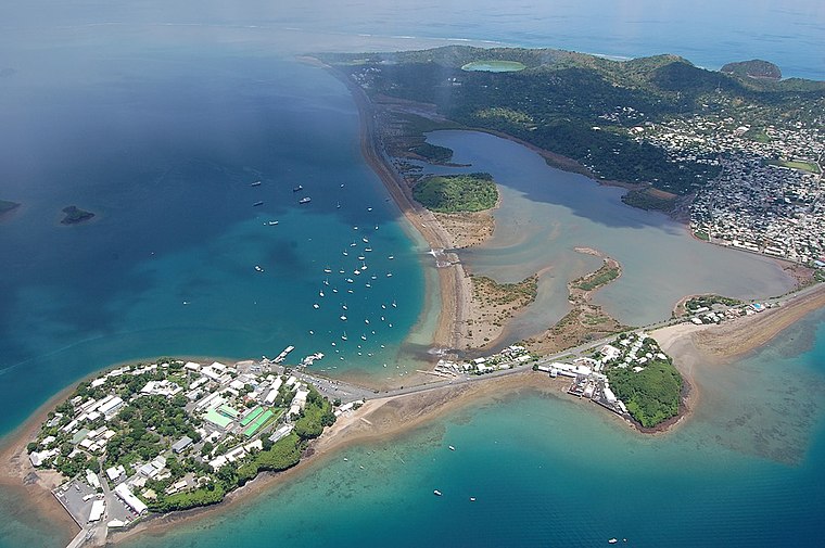
Satellite Map
Discover Service des Transports Maritimes from above in high-definition satellite imagery.
Notable Places Nearby
Highlights include Affaires Maritimes and Gendarmerie.
Nearby Places
Explore places such as Lapouz Noz and La vasière des Badamiers.
East African Islands: Must-Visit Destinations
Delve into Madagascar, Mauritius, Seychelles, and Comoros.
Curious Government Offices to Discover
Uncover intriguing government offices from every corner of the globe.
About Mapcarta. Data © OpenStreetMap contributors and available under the Open Database License". Text is available under the CC BY-SA 4.0 license, except for photos, directions, and the map. Photo: MekTypro, CC BY-SA 3.0.