Empain
Empain is a tram stop in Oudergem, Arrondissement of Brussels-Capital. Empain is situated nearby to the garden Val Duchesse - Hertoginnedal, as well as near the apartment building Maison Mauresque - Moorse Huis.| Tap on a place to explore it |
Places of Interest Nearby
Highlights include Stoclet Palace and Château of Val-Duchesse.
Stoclet Palace
Castle

Photo: Busoni, CC BY-SA 3.0.
The Stoclet Palace, also known as the Stoclet House, is a historic mansion in Woluwe-Saint-Pierre, a municipality of Brussels, Belgium. It was designed by the Austrian architect Josef Hoffmann for the Belgian financier Adolphe Stoclet, and built between 1905 and 1911, in the Vienna Secession style. Stoclet Palace is situated 1½ km northwest of Empain.
Château of Val-Duchesse
Castle
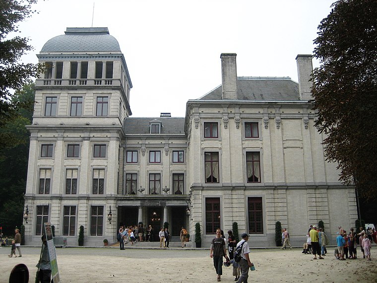
Photo: Zinneke, CC BY-SA 3.0.
The Château of Val-Duchesse is a château and estate in the municipality of Auderghem in Brussels, Belgium. The château, which occupies the site of a former priory, is owned by the Belgian Royal Trust. Château of Val-Duchesse is situated 450 metres south of Empain.
Mellaerts Ponds
Park

Photo: Delsaut, CC BY-SA 4.0.
Mellaerts Ponds is a park, which is situated 430 metres northeast of Empain.
Places in the Area
Nearby places include Val Duchesse - Hertoginnedal and Auderghem.
Val Duchesse - Hertoginnedal
Neighborhood

Photo: Wikimedia, CC BY-SA 2.5.
Val Duchesse - Hertoginnedal is a neighborhood.
Auderghem
Town

Photo: Wikimedia, Public domain.
Auderghem or Oudergem is one of the 19 municipalities of the Brussels-Capital Region, Belgium. Located in the south-eastern part of the region, along the Woluwe valley and at the entrance to the Sonian Forest, it is bordered by Etterbeek, Ixelles, Watermael-Boitsfort, and Woluwe-Saint-Pierre, as well as the Flemish municipalities of Tervuren and Overijse.
Empain
- Type: Tram stop
- Categories: railway stop, transport stop, and transportation
- Location: Oudergem, Arrondissement of Brussels-Capital, Brussels, Brussels Capital, Belgium, Benelux, Europe
- View on OpenStreetMap
Latitude
50.82398° or 50° 49′ 26″ northLongitude
4.43151° or 4° 25′ 53″ eastOpen location code
9F26RCFJ+HJOpenStreetMap ID
node 5329635374OpenStreetMap feature
public_transport=stop_positionOpenStreetMap feature
railway=tram_stop
This page is based on OpenStreetMap, Wikidata, and Wikimedia Commons.
We’d love your help improving our open data sources. Thank you for contributing.
Satellite Map
Discover Empain from above in high-definition satellite imagery.
Notable Places Nearby
Highlights include Val Duchesse - Hertoginnedal and Maison Mauresque - Moorse Huis.
Nearby Places
Explore places such as Empain and Petit étang Mellaerts - Kleine Mellaertsvijver.
Belgium: Must-Visit Destinations
Delve into Brussels, Antwerp, Ghent, and Liège.
Curious Tram Stops to Discover
Uncover intriguing tram stops from every corner of the globe.
About Mapcarta. Data © OpenStreetMap contributors and available under the Open Database License". Text is available under the CC BY-SA 4.0 license, except for photos, directions, and the map. Photo: Hullie, CC BY-SA 3.0.