Wrottesley Park Road
Wrottesley Park Road is a bus stop in Wolverhampton, England. Wrottesley Park Road is situated nearby to the forest Bedford Gorse, as well as near the village Codsall.| Tap on a place to explore it |
Places of Interest Nearby
Highlights include Codsall railway station and Bilbrook railway station.
Codsall railway station
Railway station
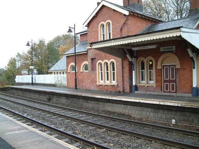
Photo: Hilary Wright, CC BY-SA 2.0.
Codsall railway station serves the village of Codsall in Staffordshire, England. Codsall railway station is situated 1 mile north of Wrottesley Park Road.
Bilbrook railway station
Railway station
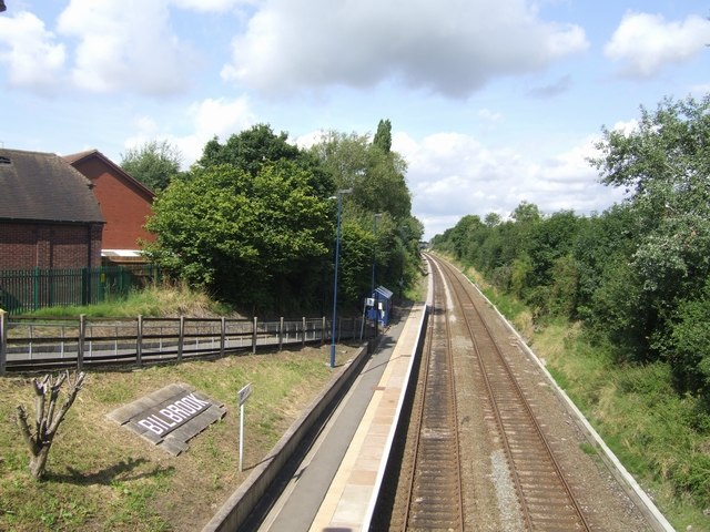
Photo: John M, CC BY-SA 2.0.
Bilbrook railway station is a railway station which serves the village of Bilbrook in Staffordshire, England. It was known as Birches and Bilbrook Halt when opened, being renamed to Bilbrook on 6 May 1974. Bilbrook railway station is situated 1 mile northeast of Wrottesley Park Road.
Wightwick Manor

Photo: Mike Peel, CC BY-SA 4.0.
Wightwick Manor is a Victorian house in Wightwick Bank, a suburb of Wolverhampton, West Midlands, England. It was commissioned in 1887 from the architect Edward Ould by Theodore Mander of Mander Brothers, a Wolverhampton paint and varnish manufacturer. Wightwick Manor is situated 2 miles south of Wrottesley Park Road.
Places in the Area
Nearby places include Codsall and Nurton.
Codsall
Village
Photo: John M, CC BY-SA 2.0.
Codsall is a village and civil parish in the South Staffordshire district of Staffordshire, England. It is situated 5 miles northwest of Wolverhampton and 13 miles east-southeast of Telford.
Nurton
Hamlet
Nurton is a hamlet in the South Staffordshire District, in the English county of Staffordshire. Nearby settlements include the city of Wolverhampton and the villages of Perton and Pattingham. Nurton is situated 2 miles southwest of Wrottesley Park Road.
Claregate
Neighborhood
Claregate is a suburb of Wolverhampton, West Midlands, England. It is north west of Wolverhampton city centre, within the Tettenhall Regis ward. Claregate is situated 2 miles east of Wrottesley Park Road.
Wrottesley Park Road
- Type: Bus stop
- Category: transportation
- Location: Wolverhampton, England, United Kingdom, Britain and Ireland, Europe
- View on OpenStreetMap
Latitude
52.61145° or 52° 36′ 41″ northLongitude
-2.20404° or 2° 12′ 15″ westOpen location code
9C4VJQ6W+H9OpenStreetMap ID
node 533879056OpenStreetMap feature
highway=bus_stopOpenStreetMap feature
public_transport=platform
This page is based on OpenStreetMap, Wikidata, and Wikimedia Commons.
We’d love your help improving our open data sources. Thank you for contributing.
Satellite Map
Discover Wrottesley Park Road from above in high-definition satellite imagery.
Notable Places Nearby
Highlights include Bedford Gorse and Oaken Nurseries.
Nearby Places
Explore places such as Wrottesley Park Road and Wrottesley Park House.
England: Must-Visit Destinations
Delve into London, Manchester, Sheffield, and Leeds.
Curious Bus Stops to Discover
Uncover intriguing bus stops from every corner of the globe.
About Mapcarta. Data © OpenStreetMap contributors and available under the Open Database License". Text is available under the CC BY-SA 4.0 license, except for photos, directions, and the map. Photo: Mariegriffiths, CC BY-SA 4.0.