Lochyside School
Lochyside School is a bus stop in Highland Council, Scotland. Lochyside School is situated nearby to the forest Eilean Mòr, as well as near the bridge Lochy Viaduct.| Tap on a place to explore it |
Places of Interest Nearby
Highlights include Banavie railway station and Neptune’s Staircase.
Banavie railway station
Railway station

Photo: T0m, Public domain.
Banavie railway station is a railway station on the West Highland Line serving the village of Banavie, although it is much closer to Caol, Scotland. It is sited between Corpach and Fort William, 22 chains from Banavie Junction, just north of Fort William. Banavie railway station is situated 3,800 feet northwest of Lochyside School.
Neptune’s Staircase

Photo: Klaus with K, CC BY-SA 3.0.
Neptune's Staircase is a staircase lock comprising eight locks on the Caledonian Canal. Built by Thomas Telford between 1803 and 1822, it is the longest staircase lock in Britain. Neptune’s Staircase is situated 1 mile north of Lochyside School.
Fort William railway station
Railway station
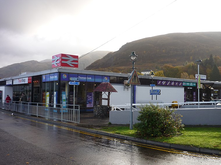
Photo: Muffingg, CC BY-SA 3.0.
Fort William railway station serves the town of Fort William, in the Highland region of Scotland. It is on the West Highland line, between Spean Bridge and Banavie, measured 99 miles 37 chains from Craigendoran Junction, at the southern end of the line near Helensburgh. Fort William railway station is situated 1¼ miles southwest of Lochyside School.
Places in the Area
Nearby places include Lochyside and Caol.

Caol
Village

Photo: Steven Brown, CC BY-SA 2.0.
Caol is a village near Fort William, in the Highland council area of Scotland. It is about 1+1⁄4 miles north of Fort William town centre, on the shore of Loch Linnhe, and is within the parish of Kilmallie.
Inverlochy
Suburb

Photo: Metrophil, CC BY-SA 3.0.
Inverlochy is a village north of Fort William, Highland, Scotland. Inverlochy is part of the Great Glen Way, a popular hiking and cycling route from Fort William to Inverness.
Lochyside School
- Type: Bus stop
- Category: transportation
- Location: Highland Council, Scotland, United Kingdom, Britain and Ireland, Europe
- View on OpenStreetMap
Latitude
56.83445° or 56° 50′ 4″ northLongitude
-5.08749° or 5° 5′ 15″ westOpen location code
9C8PRWM7+Q2OpenStreetMap ID
node 562714502OpenStreetMap feature
highway=bus_stopOpenStreetMap feature
public_transport=platform
This page is based on OpenStreetMap, Wikidata, and Wikimedia Commons.
We’d love your help improving our open data sources. Thank you for contributing.
Satellite Map
Discover Lochyside School from above in high-definition satellite imagery.
Notable Places Nearby
Highlights include Lochy Viaduct and Eilean Mòr.
Nearby Places
Explore places such as Lochyside RC Primary School and Cuil Na Sithe.
Scotland: Must-Visit Destinations
Delve into Edinburgh, Glasgow, Aberdeen, and Dundee.
Curious Bus Stops to Discover
Uncover intriguing bus stops from every corner of the globe.
About Mapcarta. Data © OpenStreetMap contributors and available under the Open Database License". Text is available under the CC BY-SA 4.0 license, except for photos, directions, and the map. Photo: Massimo Telò, CC BY-SA 4.0.