Frituur Den Industrie
Frituur Den Industrie is a fast food restaurant in Diepenbeek, Hasselt, Flanders. Frituur Den Industrie is situated nearby to the cemetery Begraafplaats Diepenbeek, as well as near the community center KLJ.| Tap on a place to explore it |
Places of Interest Nearby
Highlights include Sint-Servatiuskerk and Sapittelmolen.
Sint-Servatiuskerk
Church

Photo: Reinhardhauke, CC BY-SA 3.0.
Sint-Servatiuskerk is a church, which is situated 1 km northwest of Frituur Den Industrie.
Sapittelmolen
Watermill
 Sapittelmolen is a watermill, which is situated 730 metres northeast of Frituur Den Industrie.
Diepenbeek Castle
Castle

Photo: Paul Hermans, CC BY-SA 3.0.
Diepenbeek Castle is a castle in Diepenbeek near Hasselt in the province of Limburg, Belgium. The building consists of a 15th-century keep with a 17th-century main block. Diepenbeek Castle is situated 1¼ km northwest of Frituur Den Industrie.
Places in the Area
Nearby places include Godsheide and Onze-Lieve-Vrouw.
Godsheide
Hamlet

Photo: Paul Hermans, CC BY-SA 3.0.
Godsheide is a village and Catholic parish within the north-eastern corner of the Belgian city of Hasselt, in the province of Limburg. Between the village and the main town of Hasselt there are several large modern developments - the Hasselt golf club, the Grenslandhallen entertainment centre, the Limburg provincial government buildings, and the Kinepolis cinema complex. Godsheide is situated 5 km northwest of Frituur Den Industrie.
Onze-Lieve-Vrouw
Hamlet
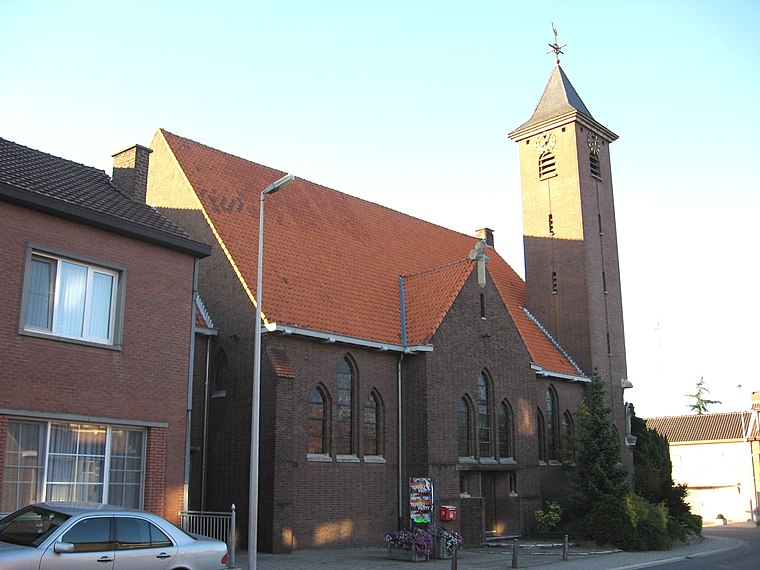
Photo: Sonuwe, CC BY-SA 3.0.
Onze-Lieve-Vrouw is a hamlet, which is situated 5 km southeast of Frituur Den Industrie.
Romershoven
Village

Photo: Sonuwe, CC BY-SA 3.0.
Romershoven is a village, which is situated 5 km southeast of Frituur Den Industrie.
Frituur Den Industrie
- Type: Fast food restaurant
- Cuisine: friture
- Categories: food and restaurant
- Location: Diepenbeek, Hasselt, Limburg, Flanders, Belgium, Benelux, Europe
- View on OpenStreetMap
Latitude
50.90218° or 50° 54′ 8″ northLongitude
5.42746° or 5° 25′ 39″ eastOpen location code
9F27WC2G+VXOpenStreetMap ID
node 5805278690OpenStreetMap feature
amenity=fast_foodOpenStreetMap attribute
cuisine=friture
This page is based on OpenStreetMap, Wikidata, and Wikimedia Commons.
We’d love your help improving our open data sources. Thank you for contributing.
Satellite Map
Discover Frituur Den Industrie from above in high-definition satellite imagery.
Notable Places Nearby
Highlights include Begraafplaats Diepenbeek and KLJ.
Nearby Places
Explore places such as Auto Vrancken and Dorpsveld.
Limburg: Must-Visit Destinations
Delve into Sint-Truiden, Tongeren, Genk, and Maasmechelen.
Curious Fast Food Restaurants to Discover
Uncover intriguing fast food restaurants from every corner of the globe.
About Mapcarta. Data © OpenStreetMap contributors and available under the Open Database License". Text is available under the CC BY-SA 4.0 license, except for photos, directions, and the map. Photo: Jeanhousen, CC BY 3.0.