Davagna
Davagna is a monitoring station in Davagna, Province of Genoa, Liguria. Davagna is situated nearby to the post office Poste Italiane, as well as near the mountain saddle Colla di Mea.| Tap on a place to explore it |
Places of Interest Nearby
Highlights include San Colombano and Passo della Scoffera.
San Colombano
Church

Photo: Wikimedia, CC BY-SA 3.0.
San Colombano is a church, which is situated 1¼ km northeast of Davagna.
Passo della Scoffera
Mountain saddle

Photo: Wikimedia, CC BY-SA 3.0.
Passo della Scoffera is a mountain saddle, which is situated 2½ km northeast of Davagna.
Santa Maria Assunta
Church

Photo: Wikimedia, CC BY-SA 3.0.
Santa Maria Assunta is a church, which is situated 2½ km south of Davagna.
Places in the Area
Nearby places include Davagna and Bargagli.
Davagna
Village
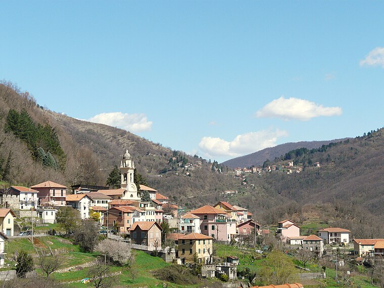
Photo: Wikimedia, CC BY-SA 3.0.
Davagna is a comune in the Metropolitan City of Genoa in the Italian region Liguria, located about 13 kilometres northeast of Genoa. The municipality of Davagna borders the following municipalities: Bargagli, Genoa, Lumarzo, Montoggio and Torriglia.
Bargagli
Village

Photo: Wikimedia, CC BY-SA 3.0.
Bargagli is a comune in the Metropolitan City of Genoa in the Italian region Liguria, located about 14 kilometres northeast of Genoa in the Val di Lentro. Bargagli borders the following municipalities: Davagna, Genoa, Lumarzo, and Sori.
Marsiglia
Hamlet

Photo: Cosmin latan, CC BY-SA 3.0.
Marsiglia is an Italian village and hamlet of the municipality of Davagna in the Province of Genoa, Liguria. As of 2009 its population was of 55. Marsiglia is situated 2½ km west of Davagna.
Davagna
- Type: Monitoring station
- Location: Davagna, Province of Genoa, Liguria, Northwest Italy, Italy, Europe
- View on OpenStreetMap
Latitude
44.46781° or 44° 28′ 4″ northLongitude
9.09539° or 9° 5′ 43″ eastElevation
467 metres (1,532 feet)Operator
ARPALOpen location code
8FPFF39W+45OpenStreetMap ID
node 5879462100OpenStreetMap feature
man_made=monitoring_station
This page is based on OpenStreetMap, Wikidata, and Wikimedia Commons.
We’d love your help improving our open data sources. Thank you for contributing.
Satellite Map
Discover Davagna from above in high-definition satellite imagery.
Places with the Same Name
Discover other places named “Davagna”.
Notable Places Nearby
Highlights include Poste Italiane and Cimitero.
Nearby Places
Explore places such as Via Bombrini F.56 and Via Bombrini 1 Di Via Poggio.
Liguria: Must-Visit Destinations
Delve into Genoa, Sanremo, La Spezia, and Savona.
Curious Monitoring Stations to Discover
Uncover intriguing monitoring stations from every corner of the globe.
About Mapcarta. Data © OpenStreetMap contributors and available under the Open Database License". Text is available under the CC BY-SA 4.0 license, except for photos, directions, and the map. Photo: Yoggysot, CC BY-SA 3.0.