La Tapasseria
La Tapasseria is a restaurant in Oudergem, Arrondissement of Brussels-Capital. La Tapasseria is situated nearby to the school Centre scolaire du Souverain, as well as near the playground Plaine de Jeux Chemin de Fer Sud - Spoorweg Zuid Speelplein.| Tap on a place to explore it |
- Opening hours: Tuesday—Saturday noon—2:00 PM and 6:00 PM—10:00 PM
- Email: info@latapasseria.com
- Type: Restaurant
- Cuisine: Peruvian
Places of Interest Nearby
Highlights include Centre scolaire du Souverain and Demey metro station.
Centre scolaire du Souverain
School

Photo: EmDee, CC BY-SA 3.0.
Centre scolaire du Souverain is a school, which is situated 110 metres southeast of La Tapasseria.
Demey metro station
Metro station

Photo: Szilas, Public domain.
Demey is a Brussels Metro station on the eastern branch of line 5. It is located in the municipality of Auderghem, in the south-eastern part of Brussels, Belgium. Demey metro station is situated 420 metres south of La Tapasseria.
Château of Val-Duchesse
Castle
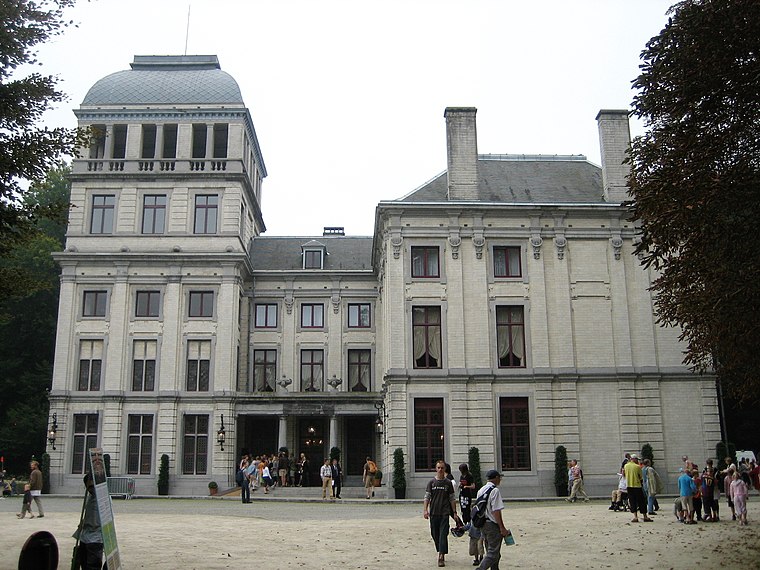
Photo: Zinneke, CC BY-SA 3.0.
The Château of Val-Duchesse is a château and estate in the municipality of Auderghem in Brussels, Belgium. The château, which occupies the site of a former priory, is owned by the Belgian Royal Trust. Château of Val-Duchesse is situated 1 km east of La Tapasseria.
Places in the Area
Nearby places include Auderghem and Woluwe.
Auderghem
Town

Photo: Wikimedia, Public domain.
Auderghem or Oudergem is one of the 19 municipalities of the Brussels-Capital Region, Belgium. Located in the south-eastern part of the region, along the Woluwe valley and at the entrance to the Sonian Forest, it is bordered by Etterbeek, Ixelles, Watermael-Boitsfort, and Woluwe-Saint-Pierre, as well as the Flemish municipalities of Tervuren and Overijse.

La Tapasseria
- Category: food
- Location: Oudergem, Arrondissement of Brussels-Capital, Brussels, Brussels Capital, Belgium, Benelux, Europe
- View on OpenStreetMap
Latitude
50.81732° or 50° 49′ 2″ northLongitude
4.42144° or 4° 25′ 17″ eastOpen location code
9F26RC8C+WHOpenStreetMap ID
node 5912301825OpenStreetMap feature
amenity=restaurantOpenStreetMap attribute
cuisine=peruvian
This page is based on OpenStreetMap, Wikidata, and Wikimedia Commons.
We’d love your help improving our open data sources. Thank you for contributing.
Satellite Map
Discover La Tapasseria from above in high-definition satellite imagery.
Notable Places Nearby
Highlights include Plaine de Jeux Chemin de Fer Sud - Spoorweg Zuid Speelplein and La Vignette.
Nearby Places
Explore places such as Hanaya Sushi and Chauffage Plomberie.
Belgium: Must-Visit Destinations
Delve into Brussels, Antwerp, Ghent, and Liège.
Curious Restaurants to Discover
Uncover intriguing restaurants from every corner of the globe.
About Mapcarta. Data © OpenStreetMap contributors and available under the Open Database License". Text is available under the CC BY-SA 4.0 license, except for photos, directions, and the map. Photo: Hullie, CC BY-SA 3.0.