Local Food Store
Local Food Store is a convenience store in Tower Hamlets, Greater London, England which is located on Salmon Lane. Local Food Store is situated nearby to Salmon Lane Evangelical Church, as well as near Locksley Estate Mosque.| Tap on a place to explore it |
Places of Interest Nearby
Highlights include Limehouse Town Hall and Limehouse station.
Limehouse Town Hall
Arts center

Photo: Nigel Cox, CC BY-SA 2.0.
Limehouse Town Hall is a former town hall building on Commercial Road, in Limehouse, in the London Borough of Tower Hamlets. It is a Grade II listed building. Limehouse Town Hall is situated 650 feet southeast of Local Food Store.
Limehouse station
Railway station
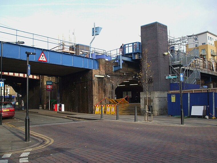
Photo: Sunil060902, CC BY-SA 3.0.
Limehouse is a National Rail and connected Docklands Light Railway station in Limehouse, London, England. It is served by regional services operated by c2c to and from Fenchurch Street and by light metro services provided by the DLR to and from Tower Gateway or Bank. Limehouse station is situated 1,400 feet west of Local Food Store.
Westferry DLR Station
Railway station

Photo: Chris j wood, CC BY-SA 3.0.
Westferry is a Docklands Light Railway station in Limehouse in London, England. It is located in London fare zone 2. To the west is Limehouse station, whilst to the east the DLR splits, with one branch going to Poplar station and the other to West India Quay station. Westferry DLR Station is situated 2,100 feet southeast of Local Food Store.
Places in the Area
Nearby places include Limehouse and Ratcliff.
Limehouse
Suburb
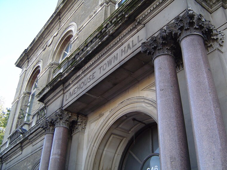
Photo: Wikimedia, CC BY-SA 3.0.
Limehouse is a district in the London Borough of Tower Hamlets in East London. It is 3.9 miles east of Charing Cross, on the northern bank of the River Thames.
Ratcliff
Quarter
Ratcliff or Ratcliffe is a locality in the London Borough of Tower Hamlets. It lies on the north bank of the River Thames between Limehouse, and Shadwell. The place name is no longer commonly used.
Cuckold’s Point
Locality
Cuckold's Point, also Cuckold's Haven, is part of a sharp bend on the River Thames on the Rotherhithe peninsula, south-east London, opposite the West India Docks and to the north of Columbia Wharf.
Local Food Store
- Type: Convenience store
- Address: 128 Salmon Lane, London, E14 7PQ
- Categories: shop and food
- Location: Tower Hamlets, Greater London, England, United Kingdom, Britain and Ireland, Europe
- View on OpenStreetMap
Latitude
51.51342° or 51° 30′ 48″ northLongitude
-0.03334° or 0° 2′ westOpen location code
9C3XGX78+9MOpenStreetMap ID
node 5998125901OpenStreetMap feature
shop=convenience
This page is based on OpenStreetMap, Wikidata, and Wikimedia Commons.
We’d love your help improving our open data sources. Thank you for contributing.
Satellite Map
Discover Local Food Store from above in high-definition satellite imagery.
Places with the Same Name
Discover other places named “Local Food Store”.
Notable Places Nearby
Highlights include Salmon Lane Evangelical Church and Locksley Estate Mosque.
Nearby Places
Explore places such as Bangla Bazar Cash & Carry and Salmon Lane Dental Care.
England: Must-Visit Destinations
Delve into London, Manchester, Sheffield, and Leeds.
Curious Convenience Stores to Discover
Uncover intriguing convenience stores from every corner of the globe.
About Mapcarta. Data © OpenStreetMap contributors and available under the Open Database License". Text is available under the CC BY-SA 4.0 license, except for photos, directions, and the map. Photo: sidibousaid, CC BY 2.0.