État civil - Burgerlijke stand
État civil - Burgerlijke stand is a government office in Antwerp, Flanders. État civil - Burgerlijke stand is situated nearby to Delta Hospital, as well as near the farmhouse Ferme Hof ter Coigne - Hoeve Hof ter Coigne.| Tap on a place to explore it |
- Opening hours: Monday—Friday 8:30 AM—1:00 PM
- Email: chirec1160@auderghem.irisnet.be
- Type: Government office
Places of Interest Nearby
Highlights include Ixelles Cemetery and Delta station.
Ixelles Cemetery
Cemetery
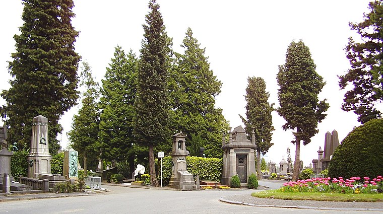
Photo: Ben2, CC BY-SA 3.0.
Ixelles Cemetery, located in Ixelles in the southern part of Brussels, is one of the major cemeteries in Belgium. Ixelles Cemetery also refers to a neighbourhood with a lot of bars and restaurants for students, north of the actual cemetery. Ixelles Cemetery is situated 460 metres west of État civil - Burgerlijke stand.
Delta station
Railway stop

Photo: Japplemedia, CC BY-SA 4.0.
Delta is a railway and metro station in the municipality of Auderghem, in the south-eastern part of Brussels, Belgium. It is located near the intersection of the Boulevard du Triomphe/Triomflaan and the Boulevard des Invalides/Invalidenlaan and provides… Delta station is situated 430 metres northeast of État civil - Burgerlijke stand.
Watermael railway station
Railway station

Photo: Arafi, CC BY-SA 2.5.
Watermael railway station or Watermaal railway station is a railway station in the municipality of Watermael-Boitsfort in Brussels, Belgium, operated by the National Railway Company of Belgium. Watermael railway station is situated 750 metres south of État civil - Burgerlijke stand.
Places in the Area
Nearby places include Boondael - Boondaal and Woluwe.
Boondael - Boondaal
Neighborhood

Photo: Waelsch, CC BY-SA 3.0.
Boondael - Boondaal is a neighborhood.

État civil - Burgerlijke stand
- Categories: office and government building
- Location: Antwerp, Flanders, Belgium, Benelux, Europe
- View on OpenStreetMap
Latitude
50.81583° or 50° 48′ 57″ northLongitude
4.40004° or 4° 24′ 0″ eastOperator
Commune d’Auderghem - Gemeente OudergemOpen location code
9F26RC82+82OpenStreetMap ID
node 6165407532OpenStreetMap feature
office=government
This page is based on OpenStreetMap, Wikidata, and Wikimedia Commons.
We’d love your help improving our open data sources. Thank you for contributing.
Satellite Map
Discover État civil - Burgerlijke stand from above in high-definition satellite imagery.
In Other Languages
From Dutch to French—“État civil - Burgerlijke stand” goes by many names.
- Dutch: “Burgerlijke stand”
- French: “État civil”
Places with the Same Name
Discover other places named “État civil - Burgerlijke stand”.
Notable Places Nearby
Highlights include Delta Hospital and Ferme Hof ter Coigne - Hoeve Hof ter Coigne.
Nearby Places
Explore places such as Tasty and Orthéis.
Antwerp: Must-Visit Destinations
Delve into Antwerp, Mechelen, Lier, and Turnhout.
Curious Government Offices to Discover
Uncover intriguing government offices from every corner of the globe.
About Mapcarta. Data © OpenStreetMap contributors and available under the Open Database License". Text is available under the CC BY-SA 4.0 license, except for photos, directions, and the map. Photo: Klaus with K, CC BY-SA 3.0.