Tejo
Tejo is in Santa Fe, Bogotá D.C., Bogotá. Tejo is situated nearby to the marketplace las nieves market, as well as near the public building Sede Central ETB.| Tap on a place to explore it |
Places of Interest Nearby
Highlights include Gold Museum and Iglesia de Nuestra Señora de las Nieves, Bogotá.
Gold Museum
Museum
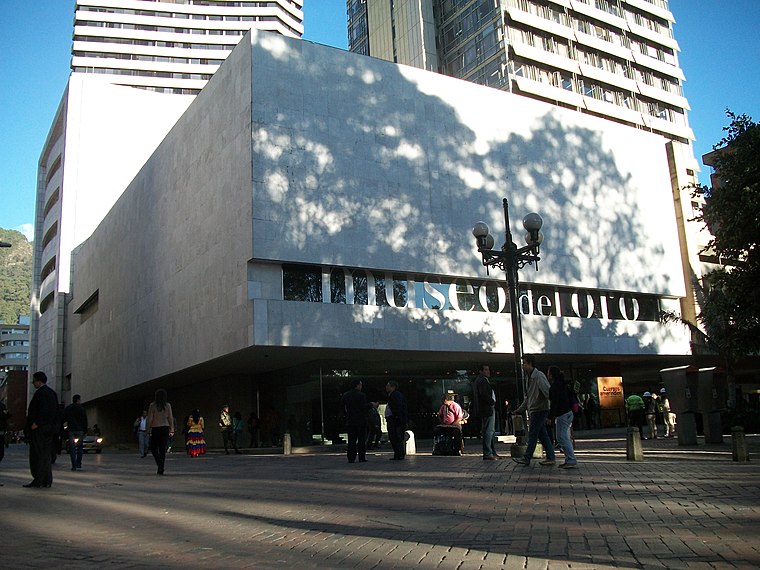
Photo: Pedro Felipe, CC BY-SA 3.0.
The Museum of Gold is an archaeology museum located in Bogotá, Colombia. It is one of the most visited touristic highlights in the country. The museum receives around 500,000 tourists per year. Gold Museum is situated 590 metres south of Tejo.
Iglesia de Nuestra Señora de las Nieves, Bogotá
Church

Photo: Pedro Felipe, CC BY-SA 3.0.
Iglesia de Nuestra Señora de las Nieves, Bogotá is a church, which is situated 180 metres southeast of Tejo.
Faenza Theatre
Theater building

Photo: Pedro Felipe, CC BY-SA 3.0.
The Faenza theatre is the oldest movie theatre in Bogotá, Colombia. It was opened on the site of a former ceramic factory on 3 April 1924 with the screening of a French film. Faenza Theatre is situated 310 metres east of Tejo.
Places in the Area
Nearby places include San Diego and La Candelaria.
San Diego
Neighborhood

Photo: Pedro Felipe, CC BY-SA 3.0.
San Diego is a neighbourhood of Bogotá, Colombia.
La Candelaria
 La Candelaria is the historic center of Bogotá, and the city's principal destination for tourists. Home to the top museums, the government palaces, and beautiful old colonial buildings along narrow cobblestone streets, it's a must see.
Tejo
- Type: Tourist attraction
- Category: tourism
- Location: Santa Fe, Bogotá D.C., Bogotá, Andino, Colombia, South America
- View on OpenStreetMap
Latitude
4.60714° or 4° 36′ 26″ northLongitude
-74.07217° or 74° 4′ 20″ westOpen location code
67P7JW4H+V4OpenStreetMap ID
node 6208781685OpenStreetMap feature
tourism=attraction
This page is based on OpenStreetMap, Wikidata, and Wikimedia Commons.
We’d love your help improving our open data sources. Thank you for contributing.
Satellite Map
Discover Tejo from above in high-definition satellite imagery.
Places with the Same Name
Discover other places named “Tejo”.
Notable Places Nearby
Highlights include las nieves market and Sede Central ETB.
Nearby Places
Explore places such as ASPE and Alhua.
Bogotá: Must-Visit Destinations
Delve into La Candelaria, Zona Rosa, Santa Fé-Los Mártires, and Usaquén.
Curious Places to Discover
Uncover intriguing places from every corner of the globe.
About Mapcarta. Data © OpenStreetMap contributors and available under the Open Database License". Text is available under the CC BY-SA 4.0 license, except for photos, directions, and the map. Photo: Wikimedia, CC BY-SA 3.0.