David L Hall
David L Hall is in Kirklees, England. David L Hall is situated nearby to the forest Howgate Wood, as well as near Be More Outdoors Horse Field.| Tap on a place to explore it |
Places of Interest Nearby
Highlights include Slaithwaite Viaduct and Slaithwaite railway station.
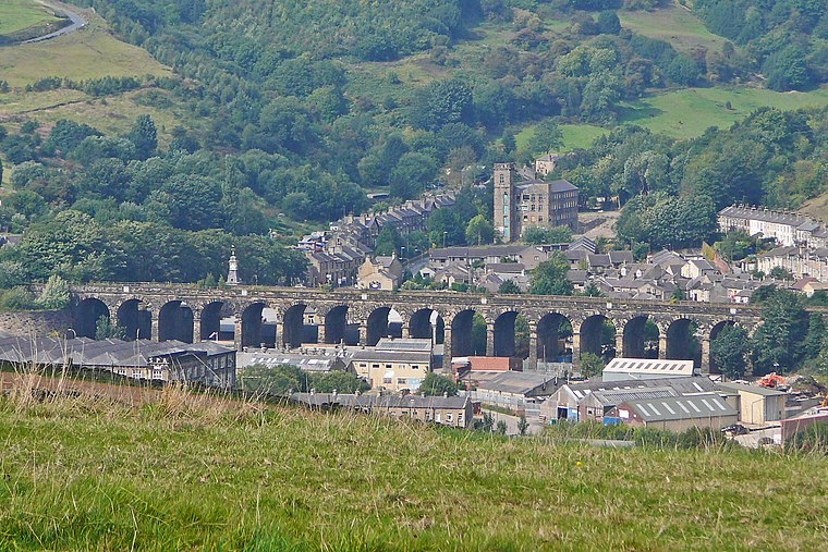
Slaithwaite Viaduct
Bridge

Photo: Betty Longbottom, CC BY-SA 2.0.
Slaithwaite Viaduct is a bridge, which is situated 830 feet northeast of David L Hall.
Slaithwaite railway station
Railway station
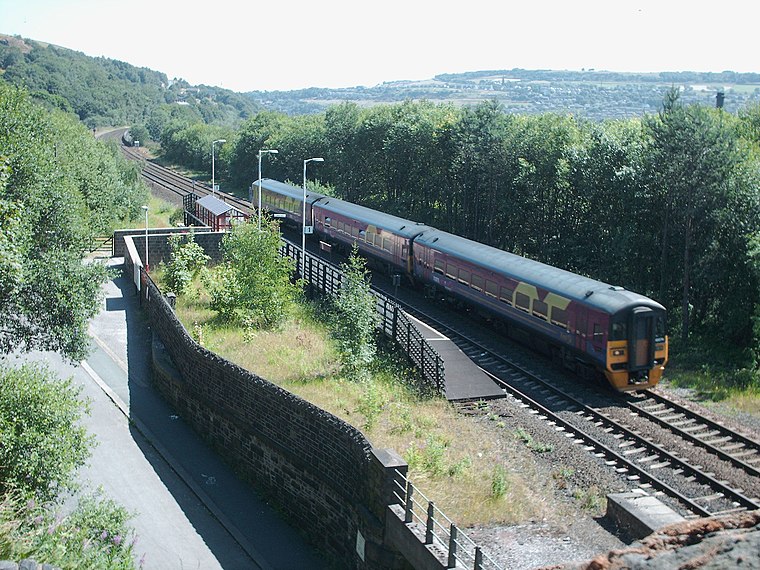 Slaithwaite railway station serves the town of Slaithwaite, West Yorkshire, England. The station is 4 miles west of Huddersfield railway station on the Huddersfield Line between Huddersfield and Manchester Victoria. Slaithwaite railway station is situated 1,800 feet northeast of David L Hall.
Shoulder Of Mutton
Pub

Photo: Pamela Norrington, CC BY-SA 2.0.
Shoulder Of Mutton is a pub, which is situated 1,200 feet northeast of David L Hall.
Places in the Area
Nearby places include Slaithwaite and Wilberlee.
Slaithwaite
Village
 Slaithwaite is a town in the Kirklees district of West Yorkshire, England. Historically part of the West Riding of Yorkshire, it is in the Colne Valley and on the Huddersfield Narrow Canal, 5 miles south-west of Huddersfield.
Wilberlee
Hamlet

Photo: Pamela Norrington, CC BY-SA 2.0.
Wilberlee is a hamlet in the Colne Valley, in the Kirklees district, in the county of West Yorkshire, England. It is near the town of Huddersfield and the village of Slaithwaite. Wilberlee has a school called Wilberlee Junior and Infant School.

David L Hall
- Type: Workshop
- Address: 26
- Location: Kirklees, England, United Kingdom, Britain and Ireland, Europe
- View on OpenStreetMap
Latitude
53.62106° or 53° 37′ 16″ northLongitude
-1.88726° or 1° 53′ 14″ westOpen location code
9C5WJ4C7+C3OpenStreetMap ID
node 6254381157OpenStreetMap feature
craft=window_construction
This page is based on OpenStreetMap, Wikidata, and Wikimedia Commons.
We’d love your help improving our open data sources. Thank you for contributing.
Satellite Map
Discover David L Hall from above in high-definition satellite imagery.
Notable Places Nearby
Highlights include Howgate Wood and Be More Outdoors Horse Field.
Nearby Places
Explore places such as Gutsibits and Coverdale.
England: Must-Visit Destinations
Delve into London, Manchester, Sheffield, and Leeds.
Curious Places to Discover
Uncover intriguing places from every corner of the globe.
About Mapcarta. Data © OpenStreetMap contributors and available under the Open Database License". Text is available under the CC BY-SA 4.0 license, except for photos, directions, and the map. Photo: sidibousaid, CC BY 2.0.