Epsom & Ewell Borough Council
Epsom & Ewell Borough Council is a government office in Epsom and Ewell District, Surrey, England. Epsom & Ewell Borough Council is situated nearby to Epsom Police Station, as well as near Epsom Town Hall.| Tap on a place to explore it |
Places of Interest Nearby
Highlights include Laine Theatre Arts and The Ashley Centre.
Laine Theatre Arts
Theater building
Laine Theatre Arts, sometimes referred to as Laines, is an independent performing arts college, based in the town of Epsom in Surrey, England. The college was founded in 1974 by former professional dancer and dance teacher Betty Laine OBE, and developed from an earlier school, the Frecker-Laine School of Dancing. Laine Theatre Arts is situated 740 feet north of Epsom & Ewell Borough Council.
The Ashley Centre
Shopping center
The Ashley Centre is a shopping centre, in Epsom, Surrey. The Ashley Centre was opened on 24 October 1984 by Queen Elizabeth II as The Ashley Centre, a development combined of shops, a multi-storey car park, office space and a theatre space. The Ashley Centre is situated 880 feet west of Epsom & Ewell Borough Council.
Epsom railway station
Railway station
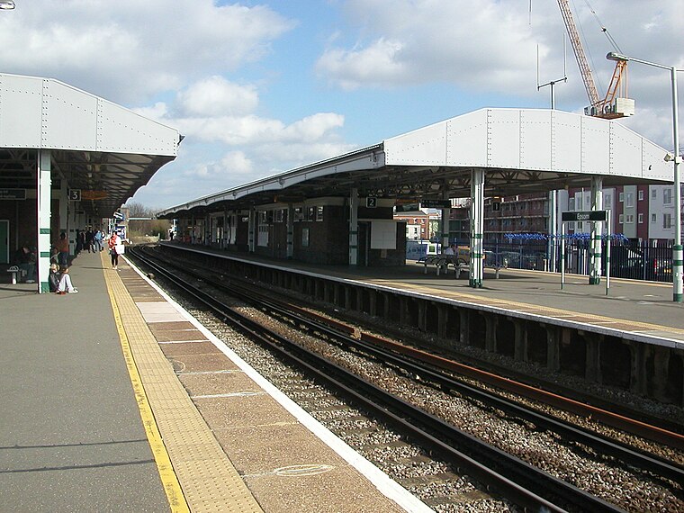
Photo: Hassocks5489, Public domain.
Epsom railway station serves the town of Epsom in Surrey, England. It is located off Waterloo Road and is less than two minutes' walk from the town's high street. It is 14 miles 18 chains down the line from London Waterloo. Epsom railway station is situated 1,200 feet northwest of Epsom & Ewell Borough Council.
Places in the Area
Nearby places include Epsom and Ewell.
Epsom

Photo: monkeywing, CC BY 2.0.
Epsom is a residential town of about 31,500 people in Surrey, 15 miles south west of London, just outside the metropolitan boundary of Greater London. Its racecourse is home to the Epsom Derby, a two-day festival of horse racing dating back to 1780.
Ewell
Town

Photo: Bobulous, CC BY-SA 4.0.
Ewell is a town in Surrey, England, 12 miles south of central London and two miles northeast of Epsom. At the 2011 Census, it had a population of 34,872.
Langley Vale
Hamlet

Photo: Hywel Williams, CC BY-SA 2.0.
Langley Vale is a village in the Borough of Epsom and Ewell, in Surrey, England, approximately 15 miles south of central London. As its name suggests, the village is in a dry valley between Epsom Downs and Walton Downs. Langley Vale is situated 2 miles south of Epsom & Ewell Borough Council.
Epsom & Ewell Borough Council
- Type: Government office
- Wheelchair access: yes
- Categories: office and government building
- Location: Epsom and Ewell District, Surrey, South East England, England, United Kingdom, Britain and Ireland, Europe
- View on OpenStreetMap
Latitude
51.33292° or 51° 19′ 59″ northLongitude
-0.26466° or 0° 15′ 53″ westOpen location code
9C3X8PMP+54OpenStreetMap ID
node 6338721195OpenStreetMap feature
office=governmentOpenStreetMap attribute
wheelchair=yes
This page is based on OpenStreetMap, Wikidata, and Wikimedia Commons.
We’d love your help improving our open data sources. Thank you for contributing.
Satellite Map
Discover Epsom & Ewell Borough Council from above in high-definition satellite imagery.
Notable Places Nearby
Highlights include Epsom Police Station and Epsom Town Hall.
Nearby Places
Explore places such as Age Concern Epsom & Ewell and Citizens Advice.
Surrey: Must-Visit Destinations
Delve into Guildford, Woking, Godalming, and Epsom.
Curious Government Offices to Discover
Uncover intriguing government offices from every corner of the globe.
About Mapcarta. Data © OpenStreetMap contributors and available under the Open Database License". Text is available under the CC BY-SA 4.0 license, except for photos, directions, and the map. Photo: Wikimedia, CC0.