GUHPS Mangammana Palya
GUHPS Mangammana Palya is a school in Bangalore (South), Bengaluru Urban, Karnataka. GUHPS Mangammana Palya is situated nearby to the sports venue fitness fury, as well as near The Oxford College of Engineering.| Tap on a place to explore it |
Places of Interest Nearby
Highlights include Indian Institute of Management Bangalore.
Indian Institute of Management Bangalore
University
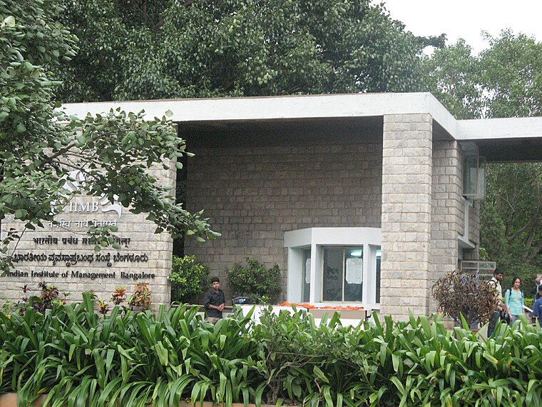
Photo: Rameshng, CC BY-SA 3.0.
Indian Institute of Management Bangalore is a reputed business school located in Bangalore, Karnataka, India. Established in 1973, it was chronologically the third in the first generation of IIMs, after IIM Calcutta and IIM Ahmedabad, thereby forming the elite Indian B-School trio colloquially known as "ABC", or "IIM A/B/C". Indian Institute of Management Bangalore is situated 3½ km west of GUHPS Mangammana Palya.
Places in the Area
Nearby places include HSR Layout and Bommanahalli.
HSR Layout
Suburb
HSR Layout, an abbreviation of Hosur Sarjapura Road Layout, is a suburb in South Eastern Bangalore, India. The locality, initially developed by the Bangalore Development Authority in 1985, has now emerged as a residential area due to its proximity to Electronic City, Sarjapur Road and the Outer Ring Road on which I.T.
Bommanahalli
Quarter
Bommanahalli is a locality in Bengaluru and one of the zones of BBMP. It is located adjacent to Hosur Road National Highway 44 in India and is proximate to the IT hub Electronics City.
Madiwala
Quarter

Photo: Rsrikanth05, CC BY-SA 3.0.
Madiwala is a locality in southeastern Bangalore, India. It is close to Koramangala, Bommanahalli, BTM Layout, HSR Layout, Arekere Mico Layout, Bannerghatta Road, Jayanagar, and J. Madiwala is situated 3 km northwest of GUHPS Mangammana Palya.
GUHPS Mangammana Palya
- Type: School
- Address: Mangammana Palya
- Category: education
- Location: Bangalore (South), Bengaluru Urban, Karnataka, Southern India, India, South Asia, Asia
- View on OpenStreetMap
Latitude
12.90421° or 12° 54′ 15″ northLongitude
77.63505° or 77° 38′ 6″ eastOpen location code
7J4VWJ3P+M2OpenStreetMap ID
node 6349546960OpenStreetMap feature
amenity=school
This page is based on OpenStreetMap, Wikidata, and Wikimedia Commons.
We’d love your help improving our open data sources. Thank you for contributing.
Satellite Map
Discover GUHPS Mangammana Palya from above in high-definition satellite imagery.
In Other Languages
“GUHPS Mangammana Palya” goes by many names.
- Kannada: “ಸರ್ಕಾರಿ ಉರ್ದು ಹಿರಿಯ ಪ್ರಾಥಮಿಕ ಶಾಲೆ ಮಂಗಮ್ಮನ ಪಾಳ್ಯ”
Notable Places Nearby
Highlights include Mangammanapalya and fitness fury.
Nearby Places
Explore places such as Al Rahi Edu Sch Bommanahalli and Newton Public School.
Karnataka: Must-Visit Destinations
Delve into Bangalore, Mysore, Mangalore, and Hampi.
Curious Schools to Discover
Uncover intriguing schools from every corner of the globe.
About Mapcarta. Data © OpenStreetMap contributors and available under the Open Database License". Text is available under the CC BY-SA 4.0 license, except for photos, directions, and the map. Photo: Pri2pais, CC BY-SA 3.0.