doelenwegwijzer 63
doelenwegwijzer 63 is in Ostend, West Flanders, Flanders. doelenwegwijzer 63 is situated nearby to the military installation Marinebasis Bootsman Jonson, as well as near the church Hazegraskerk.| Tap on a place to explore it |
Places of Interest Nearby
Highlights include Mercator and Maria Hendrikapark.
Mercator
Museum
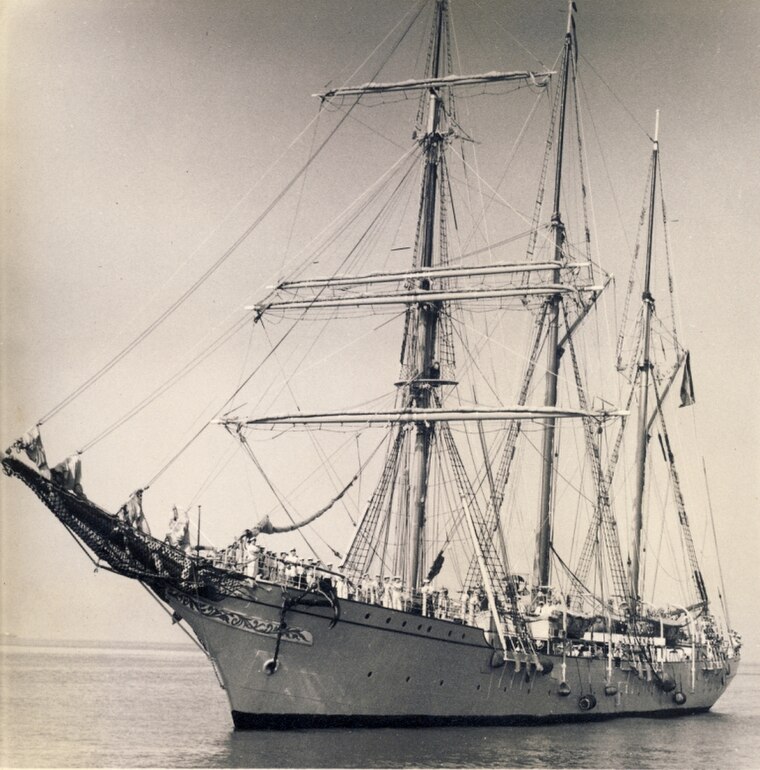
Photo: John Hill, CC BY-SA 4.0.
Mercator is a steel-hulled barquentine built in 1932 as a training ship for the Belgian merchant fleet. She was named after Gerardus Mercator, a Belgian cartographer. Mercator is situated 480 metres northwest of doelenwegwijzer 63.
Maria Hendrikapark
Park

Photo: Spinster, CC BY-SA 3.0.
Maria Hendrikapark is situated 330 metres south of doelenwegwijzer 63.
Oostende Railway Station
Railway station

Photo: Japplemedia, CC BY-SA 4.0.
Oostende railway station is a railway station in Ostend, West Flanders, Belgium. It is operated by the National Railway Company of Belgium. Oostende Railway Station is situated 580 metres north of doelenwegwijzer 63.
Places in the Area
Nearby places include Bredene and Mariakerke.
Bredene
Town

Photo: Zeemeeuw, CC BY-SA 3.0.
Bredene is a municipality located in the Belgian province of West Flanders. The municipality only comprises the town of Bredene proper. On 1 January 2006, Bredene had a total population of 15,118. Bredene is situated 3½ km northeast of doelenwegwijzer 63.
Mariakerke
Hamlet
Mariakerke is a seaside resort in the West Flanders province of Belgium. Previously a village of its own just to the west of Ostend, it now forms part of that town. Mariakerke has about 17,485 inhabitants as of 2024. Mariakerke is situated 3½ km west of doelenwegwijzer 63.

doelenwegwijzer 63
- Type: Sign
- Categories: information and tourism
- Location: Ostend, Arrondissement of Ostend, West Flanders, Flanders, Belgium, Benelux, Europe
- View on OpenStreetMap
Latitude
51.22418° or 51° 13′ 27″ northLongitude
2.92496° or 2° 55′ 30″ eastOpen location code
9F346WFF+MXOpenStreetMap ID
node 6390211207OpenStreetMap feature
tourism=information
This page is based on OpenStreetMap, Wikidata, and Wikimedia Commons.
We’d love your help improving our open data sources. Thank you for contributing.
Satellite Map
Discover doelenwegwijzer 63 from above in high-definition satellite imagery.
Notable Places Nearby
Highlights include Marinebasis Bootsman Jonson and Hazegraskerk.
Nearby Places
Explore places such as Oostende Parking and Randparking.
West Flanders: Must-Visit Destinations
Delve into Bruges, Kortrijk, Ypres, and Roeselare.
Curious Places to Discover
Uncover intriguing places from every corner of the globe.
About Mapcarta. Data © OpenStreetMap contributors and available under the Open Database License". Text is available under the CC BY-SA 4.0 license, except for photos, directions, and the map. Photo: MJJR, CC BY 3.0.