The Pig Place
The Pig Place is a restaurant in Kings Sutton, South Northamptonshire District, England. The Pig Place is situated nearby to British Microlight Aircraft Association, as well as near the forest Wilson’s Gorse.| Tap on a place to explore it |
Places of Interest Nearby
Highlights include Kings Sutton railway station and Adderbury Lakes.
Kings Sutton railway station
Railway station
Kings Sutton railway station serves the village of King's Sutton and the nearby town of Brackley in Northamptonshire, England. The station is managed by Chiltern Railways, which provides most of the services including from London Paddington and Marylebone to Oxford and Banbury. Kings Sutton railway station is situated 1 mile north of The Pig Place.
Adderbury Lakes
Nature reserve
Adderbury Lakes is a 1.8-hectare Local Nature Reserve in Adderbury in Oxfordshire. Originally part of the grounds of Adderbury House, it is now owned and managed by Adderbury Parish Council.
Church of St Peter and St Paul, Kings Sutton
Church
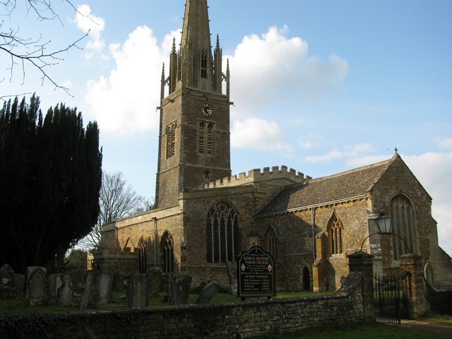
Photo: Kurt C, CC BY-SA 2.0.
Church of St Peter and St Paul, Kings Sutton is situated 1 mile north of The Pig Place.
Places in the Area
Nearby places include King’s Sutton and Aynho.
King’s Sutton
Village
King's Sutton is a village and civil parish in West Northamptonshire, Northamptonshire, England, in the valley of the River Cherwell. It is sited about 4.1 miles south-east of Banbury, Oxfordshire.
Aynho
Village
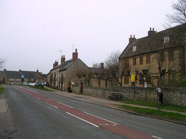
Photo: Charlesdrakew, Public domain.
Aynho is a village and civil parish in West Northamptonshire, England, on the edge of the Cherwell valley 6 miles south-east of the north Oxfordshire town of Banbury and 7 miles southwest of Brackley.
Adderbury
Village

Photo: Alan Ford, CC BY-SA 2.0.
Adderbury is a winding linear village and rural civil parish about 3 miles south of Banbury in northern Oxfordshire, England. The settlement has five sections: the new Milton Road housing Development and West Adderbury, towards the southwest; East Adderbury…
The Pig Place
- Type: Restaurant
- Category: food
- Location: Kings Sutton, South Northamptonshire District, West Northamptonshire, England, United Kingdom, Britain and Ireland, Europe
- View on OpenStreetMap
Latitude
52.00587° or 52° 0′ 21″ northLongitude
-1.28206° or 1° 16′ 55″ westOpen location code
9C4W2P49+85OpenStreetMap ID
node 6518732354OpenStreetMap feature
amenity=restaurant
This page is based on OpenStreetMap, Wikidata, and Wikimedia Commons.
We’d love your help improving our open data sources. Thank you for contributing.
Satellite Map
Discover The Pig Place from above in high-definition satellite imagery.
Notable Places Nearby
Highlights include British Microlight Aircraft Association and Wilson’s Gorse.
Nearby Places
Explore places such as The Pig Place and Banbury Business Park.
England: Must-Visit Destinations
Delve into London, Manchester, Sheffield, and Leeds.
Curious Restaurants to Discover
Uncover intriguing restaurants from every corner of the globe.
About Mapcarta. Data © OpenStreetMap contributors and available under the Open Database License". Text is available under the CC BY-SA 4.0 license, except for photos, directions, and the map. Photo: sidibousaid, CC BY 2.0.