Duddon Sands
Duddon Sands is a locality in Askam and Ireleth, Westmorland and Furness, England. Duddon Sands is situated nearby to the locality Sandscale Haws, as well as near Rabbit Warren.| Tap on a place to explore it |
Places of Interest
Highlights include North Walney Nature Reserve and Hodbarrow Beacon.
North Walney Nature Reserve
Nature reserve

Photo: Rosalind Mitchell, CC BY-SA 2.0.
North Walney Nature Reserve is a national nature reserve on Walney Island, England. The reserve, which has an area of 646.5 ha, is notable as a habitat of natterjack toads. North Walney Nature Reserve is situated 2 miles southeast of Duddon Sands.
Hodbarrow Beacon
Lighthouse
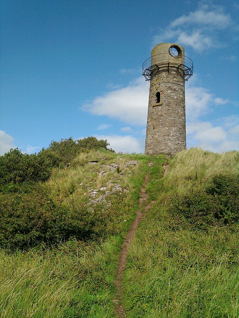
Photo: The wub, CC BY-SA 3.0.
Millom is a town and civil parish on the north shore of the estuary of the River Duddon in southernmost Cumberland, Cumbria, England. It is situated just outside the Lake District National Park, about 6 miles north of Barrow-in-Furness and 26 miles south of Whitehaven. Hodbarrow Beacon is situated 2 miles northeast of Duddon Sands.
St Luke
Church

Photo: Alexander P Kapp, CC BY-SA 2.0.
St Luke is a church, which is situated 2 miles north of Duddon Sands.
Places in the Area
Nearby places include Haverigg and Millom.
Haverigg
Village

Photo: Andrew Hill, CC BY-SA 2.0.
Haverigg is a village on the south-west coast of Cumbria, England, historically part of the county of Cumberland. In 2001 it had a population of 1,791 in 548 households, increasing in 2011 to a population of 1,849 in 549 Households. Haverigg is situated 2 miles north of Duddon Sands.
Millom
Town

Photo: Andrew Hill, CC BY-SA 2.0.
Millom is a town and civil parish on the north shore of the estuary of the River Duddon in southernmost Cumberland, Cumbria, England. It is situated just outside the Lake District National Park, about 6 miles north of Barrow-in-Furness and 26 miles south of Whitehaven. Millom is situated 3 miles north of Duddon Sands.
North Scale
Village
North Scale is a village and one of only four settlements on the Isle of Walney, Cumbria, England. It is the northernmost settlement, lying a mile north of Vickerstown. North Scale is situated 3½ miles south of Duddon Sands.
Duddon Sands
Latitude
54.16738° or 54° 10′ 3″ northLongitude
-3.28306° or 3° 16′ 59″ westOpen location code
9C6R5P88+XQOpenStreetMap ID
node 663467114OpenStreetMap feature
place=locality
This page is based on OpenStreetMap, Wikidata, and Wikimedia Commons.
We’d love your help improving our open data sources. Thank you for contributing.
Satellite Map
Discover Duddon Sands from above in high-definition satellite imagery.
Localities in the Area
Explore places such as Sandscale Haws and Rabbit Warren.
Notable Places Nearby
Highlights include Lowsy Point and Hodbarrow Lighthouse.
Cumbria: Must-Visit Destinations
Delve into Carlisle, Barrow-in-Furness, Kendal, and Penrith.
Curious Localities to Discover
Uncover intriguing localities from every corner of the globe.
About Mapcarta. Data © OpenStreetMap contributors and available under the Open Database License". Text is available under the CC BY-SA 4.0 license, except for photos, directions, and the map. Photo: ramsd, CC BY 2.0.