U2
U2 is a supermarket in Verzuolo, Province of Cuneo, Piedmont which is located on Piazza Martiri della Libertà. U2 is situated nearby to the town hall Municipio di Verzuolo, as well as near the police station Carabinieri.| Tap on a place to explore it |
Places of Interest Nearby
Highlights include Verzuolo railway station and Santa Maria della Scala.
Verzuolo railway station
Railway station

Photo: Wikimedia, CC BY-SA 3.0.
Verzuolo railway station is situated 290 metres east of U2.
Santa Maria della Scala
Church
 Santa Maria della Scala is a church, which is situated 490 metres south of U2.
Verzuolo Castle
Castle
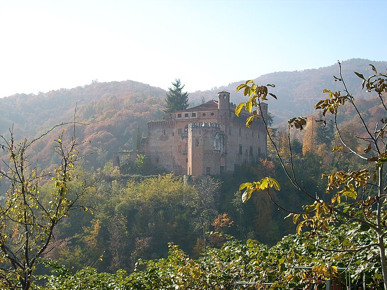 Verzuolo Castle is a medieval castle in the Piedmont region of Italy. It is located in the Province of Cuneo near Verzuolo, around 3 miles south of Saluzzo. Verzuolo Castle is situated 1¼ km northwest of U2.
Places in the Area
Nearby places include Castellar and Santa Cristina di Tarantasca.
Castellar
Village

Photo: F Ceragioli, CC BY-SA 3.0.
Castellar was a comune in the Province of Cuneo in the Italian region Piedmont, located about 50 kilometres southwest of Turin and about 30 kilometres northwest of Cuneo. As of 31 December 2004, it had a population of 253 and an area of 3.8 square kilometres. Castellar is situated 4½ km northwest of U2.
Santa Cristina di Tarantasca
Hamlet

Photo: Dario52, Public domain.
Santa Cristina di Tarantasca is a hamlet, which is situated 10 km southeast of U2.
U2
- Type: Supermarket
- Address: Piazza Martiri della Libertà 4/a, Verzuolo, 12039
- Categories: shop and food
- Location: Verzuolo, Province of Cuneo, Piedmont, Northwest Italy, Italy, Europe
- View on OpenStreetMap
Latitude
44.5993° or 44° 35′ 58″ northLongitude
7.48353° or 7° 29′ 1″ eastBrand
U2Open location code
8FP9HFXM+PCOpenStreetMap ID
node 7377364557OpenStreetMap feature
shop=supermarket
This page is based on OpenStreetMap, Wikidata, and Wikimedia Commons.
We’d love your help improving our open data sources. Thank you for contributing.
Satellite Map
Discover U2 from above in high-definition satellite imagery.
Notable Places Nearby
Highlights include Municipio di Verzuolo and Carabinieri.
Nearby Places
Explore places such as Banca di Caraglio and Farmacia San Bernardo.
Piedmont: Must-Visit Destinations
Delve into Turin, Novara, Asti, and Alessandria.
Curious Supermarkets to Discover
Uncover intriguing supermarkets from every corner of the globe.
About Mapcarta. Data © OpenStreetMap contributors and available under the Open Database License". Text is available under the CC BY-SA 4.0 license, except for photos, directions, and the map. Photo: Wikimedia, CC BY-SA 3.0.