Forbes Road 11
Forbes Road 11 is an electrical substation in Edinburgh, Scotland. Forbes Road 11 is situated nearby to John Livingstone’s Tomb, as well as near the neighborhood Greenhill.| Tap on a place to explore it |
Places of Interest Nearby
Highlights include Edinburgh Castle and Church Hill Theatre.
Edinburgh Castle
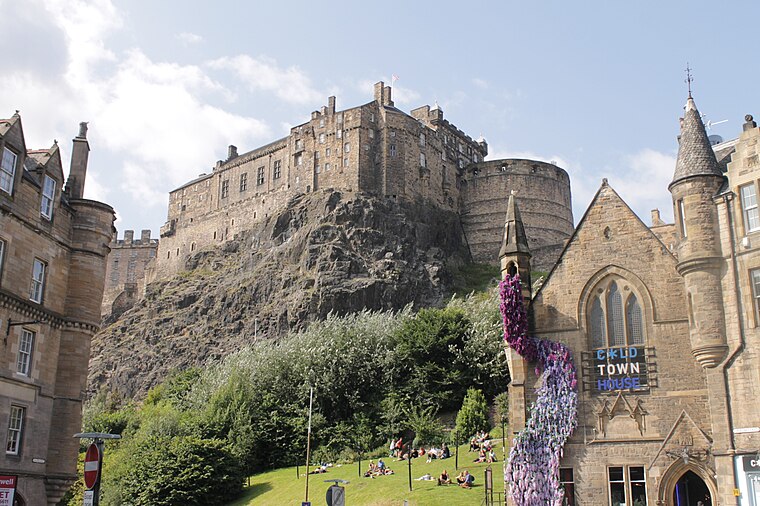
Photo: Stephencdickson, CC BY-SA 4.0.
Edinburgh Castle is a historic castle in Edinburgh, Scotland. It stands on Castle Rock, which has been occupied by humans since at least the Iron Age. There has been a royal castle on the rock since the reign of Malcolm III in the 11th century, and the castle continued to be a royal residence until 1633. Edinburgh Castle is situated 1 mile north of Forbes Road 11.
Church Hill Theatre
Theater building

Photo: Kim Traynor, CC BY-SA 3.0.
Church Hill Theatre is a Category B listed pink sandstone former church and current theatre venue owned by the Edinburgh City Council. Built originally as Morningside Free Church, the council purchased it in 1960. Church Hill Theatre is situated 1,100 feet south of Forbes Road 11.
Christ Church, Bruntsfield Place, Edinburgh
Church

Photo: Jonathan Oldenbuck, CC BY-SA 4.0.
Christ Church, Bruntsfield Place, Edinburgh is situated 740 feet southwest of Forbes Road 11.
Places in the Area
Nearby places include Greenhill and Bruntsfield.
Greenhill
Neighborhood

Photo: Kim Traynor, CC BY-SA 3.0.
Greenhill is a small area of Edinburgh, the capital of Scotland. Situated south of the city centre, Greenhill is normally taken to be part of Bruntsfield, which skirts it to the north.
Bruntsfield
Suburb

Photo: Kim Traynor, CC BY-SA 3.0.
Bruntsfield is a largely residential area around Bruntsfield Place in Southern Edinburgh, Scotland. In feudal times, it fell within the barony of Colinton.
Church Hill
Neighborhood

Photo: Kim Traynor, CC BY-SA 3.0.
Church Hill is a street and small surrounding area in Edinburgh, Scotland.
Forbes Road 11
- Type: Electrical substation
- Category: industry
- Location: Edinburgh, Scotland, United Kingdom, Britain and Ireland, Europe
- View on OpenStreetMap
Latitude
55.93538° or 55° 56′ 7″ northLongitude
-3.20736° or 3° 12′ 27″ westOperator
SP Energy NetworksOpen location code
9C7RWQPV+53OpenStreetMap ID
node 7526795739
This page is based on OpenStreetMap, Wikidata, and Wikimedia Commons.
We’d love your help improving our open data sources. Thank you for contributing.
Satellite Map
Discover Forbes Road 11 from above in high-definition satellite imagery.
Notable Places Nearby
Highlights include John Livingstone’s Tomb and Edinburgh Iyengar Yoga Centre.
Nearby Places
Explore places such as Forbes Childrens Nursery and Bruntsfield Medical Practice.
Edinburgh: Must-Visit Destinations
Delve into Old Town, New Town, West Edinburgh, and Leith.
Curious Electrical Substations to Discover
Uncover intriguing electrical substations from every corner of the globe.
About Mapcarta. Data © OpenStreetMap contributors and available under the Open Database License". Text is available under the CC BY-SA 4.0 license, except for photos, directions, and the map. Photo: Wikimedia, CC BY 3.0.