Melling (St Wilfrid CEPS)
Melling (St Wilfrid CEPS) is a bus stop in Melling-with-Wrayton, Lancaster, England. Melling (St Wilfrid CEPS) is situated nearby to Melling St Wilfrid Church of England Primary School, as well as near St Wilfrid’s Church.| Tap on a place to explore it |
Places of Interest Nearby
Highlights include St Wilfrid’s Church and St John the Baptist’s Church, Arkholme.
St Wilfrid’s Church
Church

Photo: Wikimedia, CC BY-SA 2.0.
St Wilfrid's Church is in Main Street, Melling, Lancashire, England. It is recorded in the National Heritage List for England as a designated Grade I listed building, and is an active Anglican church in the united benefice of East Lonsdale, the deanery of Tunstall, the archdeaconry of Lancaster and the diocese of Blackburn. St Wilfrid’s Church is situated 1,300 feet west of Melling (St Wilfrid CEPS).
St John the Baptist’s Church, Arkholme
Church

Photo: Alexander P Kapp, CC BY-SA 2.0.
St John the Baptist's Church, is in the village of Arkholme, Lancaster, Lancashire, England. It is an active Anglican parish church in the deanery of Tunstall, the archdeaconry of Lancaster, and the diocese of Blackburn. St John the Baptist’s Church, Arkholme is situated 1 mile northwest of Melling (St Wilfrid CEPS).
Wennington railway station
Railway station

Photo: SIMON PHILLIPS, CC BY-SA 2.0.
Wennington is a railway station on the Bentham Line, which runs between Leeds and Morecambe via Skipton. The station, situated 15+3⁄4 miles east of Lancaster, serves the village of Wennington in Lancashire. Wennington railway station is situated 1¼ miles southeast of Melling (St Wilfrid CEPS).
Places in the Area
Nearby places include Cantsfield and Hornby.
Cantsfield
Hamlet
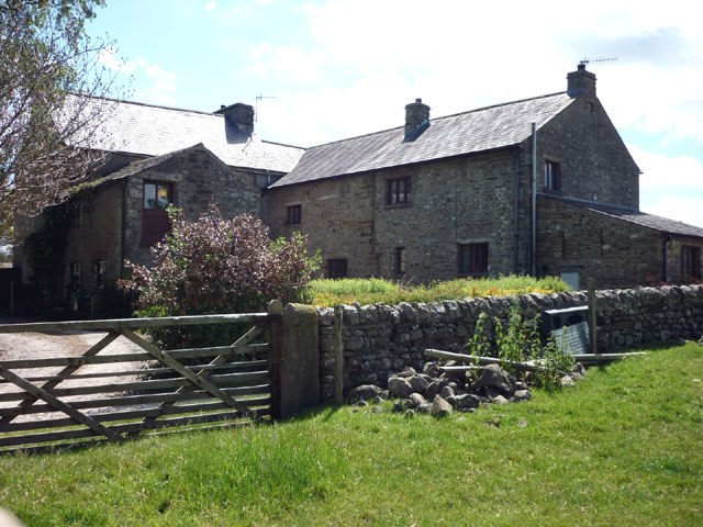
Photo: Wikimedia, CC BY-SA 2.0.
Cantsfield is a hamlet and civil parish in the City of Lancaster, in Lancashire, England, near the boundary with North Yorkshire. It is situated near the River Greta and on the A687 road near the junction with the A683. Cantsfield is situated 1½ miles northeast of Melling (St Wilfrid CEPS).
Hornby
Village

Photo: Kate Jewell, CC BY-SA 2.0.
Hornby is a village and former civil parish located 9 miles from Lancaster, now part of the parish of Hornby-with-Farleton, within the Lancaster district of the county of Lancashire, England. Hornby is situated 2 miles southwest of Melling (St Wilfrid CEPS).
Wray
Village

Photo: Alexander P Kapp, CC BY-SA 2.0.
Wray is a small village in Lancashire, England, part of the civil parish of Wray-with-Botton, in the City of Lancaster district. Wray is the point at which the River Roeburn joins the River Hindburn. Wray is situated 2½ miles south of Melling (St Wilfrid CEPS).
Melling (St Wilfrid CEPS)
- Type: Bus stop
- Categories: transport stop and transportation
- Location: Melling-with-Wrayton, Lancaster, Lancashire, North West England, England, United Kingdom, Britain and Ireland, Europe
- View on OpenStreetMap
Latitude
54.13496° or 54° 8′ 6″ northLongitude
-2.61028° or 2° 36′ 37″ westOpen location code
9C6V49MQ+XVOpenStreetMap ID
node 7615105074OpenStreetMap feature
public_transport=stop_position
This page is based on OpenStreetMap, Wikidata, and Wikimedia Commons.
We’d love your help improving our open data sources. Thank you for contributing.
Satellite Map
Discover Melling (St Wilfrid CEPS) from above in high-definition satellite imagery.
Notable Places Nearby
Highlights include Melling St Wilfrid Church of England Primary School and Melling Village Hall.
Nearby Places
Explore places such as Melling (St Wilfrid CEPS) and Galley Hill Farm.
Lancashire: Must-Visit Destinations
Delve into Blackpool, Blackburn, Preston, and Burnley.
Curious Bus Stops to Discover
Uncover intriguing bus stops from every corner of the globe.
About Mapcarta. Data © OpenStreetMap contributors and available under the Open Database License". Text is available under the CC BY-SA 4.0 license, except for photos, directions, and the map. Photo: Antiquary, CC BY 4.0.