Brodick Community Fire Station
Brodick Community Fire Station is a fire station in North Ayrshire, Scotland. Brodick Community Fire Station is situated nearby to Arran Free Church of Scotland, as well as near Arran Library.| Tap on a place to explore it |
Places of Interest Nearby
Highlights include Brodick Castle.
Brodick Castle
Castle
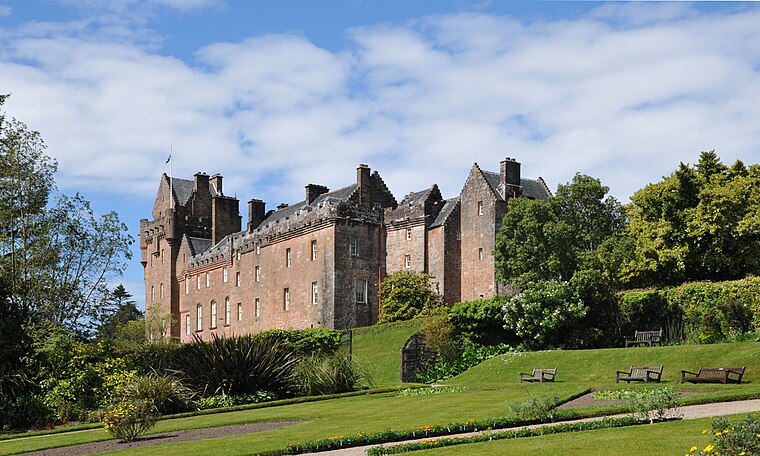
Photo: Sir Gawain, CC BY-SA 3.0.
Brodick Castle is a castle situated outside the port of Brodick on the Isle of Arran, an island in the Firth of Clyde, Scotland. It was previously a seat of the Dukes of Hamilton, but is now owned by the National Trust for Scotland. Brodick Castle is situated 1¼ miles north of Brodick Community Fire Station.
Places in the Area
Nearby places include Brodick and Strathwhillan.
Brodick
Village

Photo: Dave souza, CC BY-SA 2.5.
Brodick is the main village on the Isle of Arran, in the Firth of Clyde, Scotland. It is halfway along the east coast of the island, in Brodick Bay below Goat Fell, the tallest mountain on Arran.
Strathwhillan
Neighborhood

Photo: Alan Reid, CC BY-SA 2.0.
Strathwhillan is a tiny community on the Isle of Arran in the Firth of Clyde, Scotland. It is really a suburb of the much larger village of Brodick. There are no amenities to speak of in the area, save for a local guest house.
Home Farm
Locality
Home Farm was the estate farm for Brodick Castle. It now houses a series of tourist enterprises including a cheese shop and Arran Aromatics. This was the site of the curiously named Khartoum which was a kind of shanty town.
Brodick Community Fire Station
- Type: Fire station
- Location: North Ayrshire, Scotland, United Kingdom, Britain and Ireland, Europe
- View on OpenStreetMap
Latitude
55.57645° or 55° 34′ 35″ northLongitude
-5.15117° or 5° 9′ 4″ westOperator
Scottish Fire and Rescue ServiceOpen location code
9C7PHRGX+HGOpenStreetMap ID
node 761845582OpenStreetMap feature
amenity=fire_station
This page is based on OpenStreetMap, Wikidata, and Wikimedia Commons.
We’d love your help improving our open data sources. Thank you for contributing.
Satellite Map
Discover Brodick Community Fire Station from above in high-definition satellite imagery.
Notable Places Nearby
Highlights include Arran Free Church of Scotland and Arran Library.
Nearby Places
Explore places such as Brodick Telephone Exchange and Invercloy.
Scotland: Must-Visit Destinations
Delve into Edinburgh, Glasgow, Aberdeen, and Dundee.
Curious Fire Stations to Discover
Uncover intriguing fire stations from every corner of the globe.
About Mapcarta. Data © OpenStreetMap contributors and available under the Open Database License". Text is available under the CC BY-SA 4.0 license, except for photos, directions, and the map. Photo: Ritchyblack, FAL.