SPAR city Monarch
SPAR city Monarch is a convenience store in The Hague, Rotterdam-The Hague Metropolitan Region, South Holland which is located on Prinses Beatrixlaan. SPAR city Monarch is situated nearby to the railway stop Beatrixkwartier RandstadRail station, as well as near the bridge Netkous.| Tap on a place to explore it |
- Opening hours:
Monday—Friday: 7:00 AM—9:00 PM
Saturday: 9:00 AM—8:00 PM
Sunday: 9:00 AM—5:00 PM - Type: Convenience store
- Address: Prinses Beatrixlaan 9, ‘s-Gravenhage, 2595AK
Places of Interest Nearby
Highlights include Royal Library of the Netherlands and Netkous.
Royal Library of the Netherlands
Library
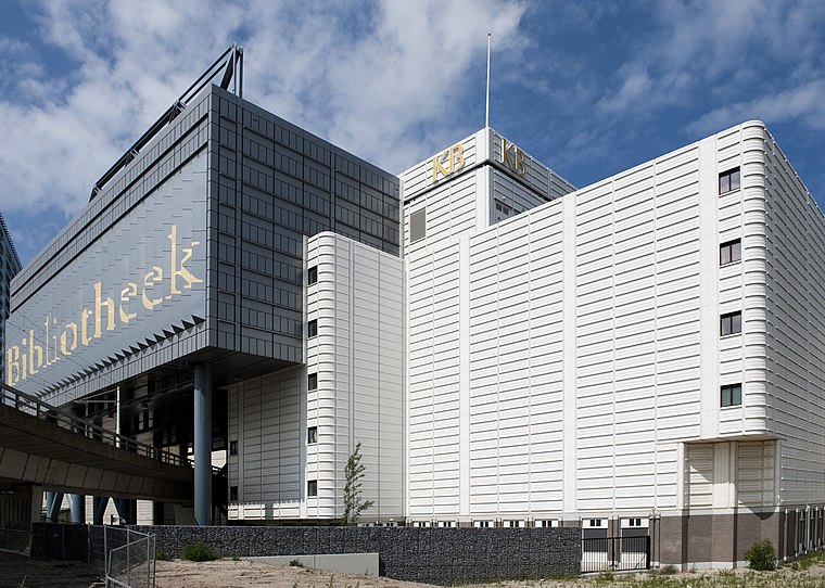
Photo: Koninklijke Bibliotheek, CC BY-SA 2.0.
The KB National Library of the Netherlands is the national library of the Netherlands, based in The Hague, founded in 1798. The KB collects everything that is published in and concerning the Netherlands, from medieval literature to today's publications. Royal Library of the Netherlands is situated 470 metres west of SPAR city Monarch.
Netkous
Bridge

Photo: Ben Bender, CC BY-SA 3.0.
The Netkous or Fishnets is the popular name for the tram bridge in The Hague district Bezuidenhout built between 2004 and 2006. The viaduct is along the Prinses Beatrixlaan.
Beatrixkwartier RandstadRail station
Railway stop

Photo: Michiel1972, CC BY-SA 3.0.
Beatrixkwartier is a RandstadRail station in the Beatrixkwartier district in The Hague, Netherlands.
Places in the Area
Nearby places include Bezuidenhout and Rivierenbuurt, The Hague.
Bezuidenhout
Quarter
Bezuidenhout is the neighbourhood southeast of the Haagse Bos district of The Hague in the Netherlands. Bezuidenhout includes the Beatrixkwartier financial area near the Central Station and streets such as Bezuidenhoutseweg, Juliana van Stolberglaan, Laan van Nieuw Oost-Indië, Prins Clauslaan, and Theresiastraat.
Rivierenbuurt, The Hague
Neighborhood

Photo: Wikimedia, CC BY-SA 4.0.
Rivierenbuurt, The Hague is a neighborhood.

SPAR city Monarch
- Categories: shop and food
- Location: The Hague, Rotterdam-The Hague Metropolitan Region, South Holland, Western Netherlands, Netherlands, Benelux, Europe
- View on OpenStreetMap
Latitude
52.08022° or 52° 4′ 49″ northLongitude
4.3341° or 4° 20′ 3″ eastOpen location code
9F4638JM+3JOpenStreetMap ID
node 7647051492OpenStreetMap feature
shop=convenience
This page is based on OpenStreetMap, Wikidata, and Wikimedia Commons.
We’d love your help improving our open data sources. Thank you for contributing.
Satellite Map
Discover SPAR city Monarch from above in high-definition satellite imagery.
Notable Places Nearby
Highlights include Beatrixkwartier and Zendmast Bezuidenhout.
Nearby Places
Explore places such as Den Haag, Prinses Marijkestraat and Prinses Marijkestraat.
Rotterdam-The Hague Metropolitan Region: Must-Visit Destinations
Delve into Rotterdam, Delft, Zoetermeer, and Centrum.
Curious Convenience Stores to Discover
Uncover intriguing convenience stores from every corner of the globe.
About Mapcarta. Data © OpenStreetMap contributors and available under the Open Database License". Text is available under the CC BY-SA 4.0 license, except for photos, directions, and the map. Photo: 1Veertje, CC BY-SA 3.0.