UPZ Los Cedros
UPZ Los Cedros is a quarter in Usaquen, Bogotá D.C., Bogotá. UPZ Los Cedros is situated nearby to the neighborhood La Morada, as well as near Capri.| Tap on a place to explore it |
Places of Interest
Highlights include Bogotá Colombia Temple and Embassy of Honduras.
Bogotá Colombia Temple
Church
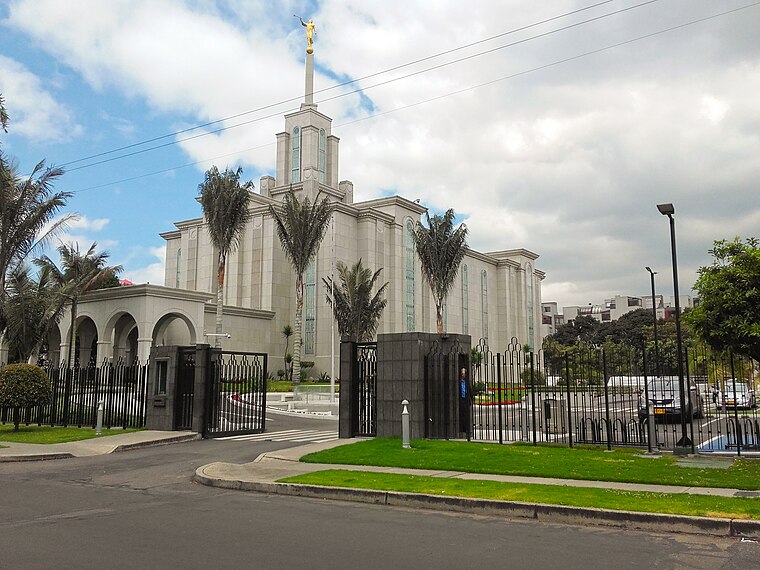
Photo: EEIM, CC BY-SA 4.0.
The Bogotá Colombia Temple is the 57th operating temple of the Church of Jesus Christ of Latter-day Saints. Bogotá Colombia Temple is situated 3 km southwest of UPZ Los Cedros.
Embassy of Honduras
Government office

Photo: Aquintero82, CC BY-SA 4.0.
Embassy of Honduras is a government office, which is situated 3 km south of UPZ Los Cedros.
North Point Building Complex

Photo: Pedro Felipe, CC BY-SA 3.0.
The North Point Building Complex is an office skyscraper complex in Bogotá, Colombia. Built between 2008 and 2017, the complex comprises five buildings with the tallest standing at 172 m with 45 floors, which is the current 11th tallest building in Colombia.
Places in the Area
Nearby places include Usaquén and Northwest Bogotá.
Usaquén

Photo: Pedro Felipe, CC BY-SA 3.0.
Usaquén is one of the largest districts in Bogota with nearly 1 million citizens. Usaquen is where many of the wealthiest and most affluent neighborhoods in the city are located, being the seat to huge high-end shopping malls, luxury boutiques, vast financial…
Northwest Bogotá

Photo: Pedro Felipe, CC BY-SA 3.0.
Northwest Bogotá is comprised majorly by the locality of Suba, and a small part of the locality of Barrios Unidos. The locality of Suba is the most populous district in Bogota, with over 1 and a half million citizens, it is almost its own independent city.
La Castellana
Neighborhood

Photo: Pedro Felipe, CC BY-SA 3.0.
La Castellana is a neighborhood, which is situated 6 km southwest of UPZ Los Cedros.
UPZ Los Cedros
- Type: Quarter
- Category: locality
- Location: Usaquen, Bogotá D.C., Bogotá, Andino, Colombia, South America
- View on OpenStreetMap
Latitude
4.7244° or 4° 43′ 28″ northLongitude
-74.03524° or 74° 2′ 7″ westOpen location code
67P7PXF7+QWOpenStreetMap ID
node 7661814126OpenStreetMap feature
place=quarter
This page is based on OpenStreetMap, Wikidata, and Wikimedia Commons.
We’d love your help improving our open data sources. Thank you for contributing.
Satellite Map
Discover UPZ Los Cedros from above in high-definition satellite imagery.
Localities in the Area
Explore places such as La Morada and Capri.
Notable Places Nearby
Highlights include Parque Cedritos and San Tarcisio.
Bogotá: Must-Visit Destinations
Delve into La Candelaria, Zona Rosa, Santa Fé-Los Mártires, and Usaquén.
Curious Quarters to Discover
Uncover intriguing quarters from every corner of the globe.
About Mapcarta. Data © OpenStreetMap contributors and available under the Open Database License". Text is available under the CC BY-SA 4.0 license, except for photos, directions, and the map. Photo: Wikimedia, CC BY-SA 3.0.