Colle di Pra Reale
Colle di Pra Reale is a mountain saddle in Roure, Province of Turin, Piedmont. Colle di Pra Reale is situated nearby to the locality Costa di Glantin, as well as near Bergeria del Laus.| Tap on a place to explore it |
Places of Interest
Highlights include Orsiera-Rocciavrè Natural Park and Monte Rocciavrè.
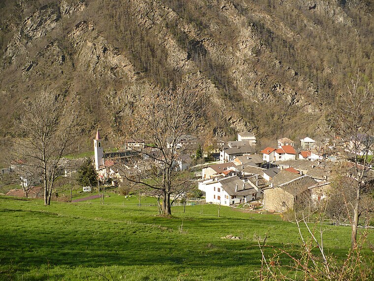
Orsiera-Rocciavrè Natural Park
Nature reserve

Photo: Keduqu, CC BY-SA 4.0.
The Orsiera-Rocciavrè Natural Park is a nature reserve in Piedmont, Italy. Established in 1980, it covers a vast Alpine area between the Val Susa and the Val Chisone, in the Graian Alps and the Cottian Alps.


Places in the Area
Nearby places include Roure and Villaretto.
Roure
Village
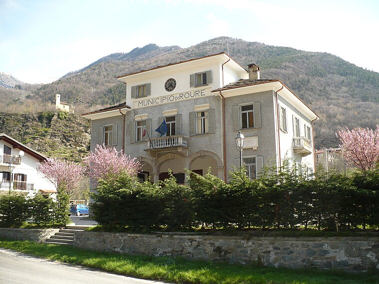
Photo: Francofranco56, Public domain.
Roure is a comune in the Metropolitan City of Turin in the Italian region of Piedmont, located about 45 kilometres west of Turin in the Val Chisone. Roure borders the following municipalities: Bussoleno, San Giorio di Susa, Mattie, Coazze, Fenestrelle, Perosa Argentina, Massello, and Perrero.

Colle di Pra Reale
- Type: Mountain saddle
- Category: landform
- Location: Roure, Province of Turin, Piedmont, Northwest Italy, Italy, Europe
- View on OpenStreetMap
Latitude
45.0516° or 45° 3′ 6″ northLongitude
7.1547° or 7° 9′ 17″ eastOpen location code
8FQ93523+JVOpenStreetMap ID
node 7727256829OpenStreetMap feature
natural=saddle
This page is based on OpenStreetMap, Wikidata, and Wikimedia Commons.
We’d love your help improving our open data sources. Thank you for contributing.
Satellite Map
Discover Colle di Pra Reale from above in high-definition satellite imagery.
Localities in the Area
Explore places such as Costa di Glantin and Bergeria del Laus.
Notable Places Nearby
Highlights include Monte Rocciavrè Occidentale and Colle Superiore di Malanotte.
Piedmont: Must-Visit Destinations
Delve into Turin, Novara, Asti, and Alessandria.
Curious Mountain Saddles to Discover
Uncover intriguing mountain saddles from every corner of the globe.
About Mapcarta. Data © OpenStreetMap contributors and available under the Open Database License". Text is available under the CC BY-SA 4.0 license, except for photos, directions, and the map. Photo: Toma15996, CC BY-SA 4.0.