Wellburn Street
Wellburn Street is a bus stop in Dundee City, Scotland. Wellburn Street is situated nearby to Kerr Street Community Garden, as well as near the church Christian Assembly Hall.| Tap on a place to explore it |
Places of Interest Nearby
Highlights include Mills Observatory and Dundee Ice Arena.
Mills Observatory

Photo: Cyrillic, CC BY-SA 3.0.
Mills Observatory is the first purpose-built public astronomical observatory in the UK, located on the summit of Balgay Hill in Dundee, Scotland. Built in 1935, the observatory is classically styled in sandstone and has a distinctive 7 m dome, which houses a Victorian refracting telescope, a small planetarium, and display areas. Mills Observatory is situated 3,200 feet southeast of Wellburn Street.
Dundee Ice Arena
Ice rink
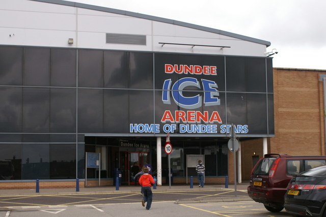
Photo: Mike Pennington, CC BY-SA 2.0.
Dundee Ice Arena, a multifaceted ice rink facility, is situated in the Camperdown locality of Dundee, Scotland. Boasting a seating capacity of 2,400, it ranks as the fourth largest ice rink in Scotland, surpassed only by Braehead Arena, Murrayfield Ice Rink, and Fife Ice Arena. Dundee Ice Arena is situated 3,600 feet north of Wellburn Street.
Royal Victoria Hospital
Hospital
Royal Victoria Hospital, Dundee is a hospital in Dundee, Scotland. It was formerly known as the Victoria Hospital for Incurables. The hospital is primarily dedicated to medicine for the elderly and is managed by NHS Tayside. Royal Victoria Hospital is situated 3,800 feet southeast of Wellburn Street.
Places in the Area
Nearby places include Dryburgh and Menzieshill.
Dryburgh
Suburb
Dryburgh is a residential district of Dundee, Scotland, located in the western part of the city. The area primarily consists of housing estates and local amenities, with strong community ties and a notable presence in Dundee’s football and music scenes.
Menzieshill
Suburb
Menzieshill is a suburb and community council area in Dundee, Scotland. It is located in the west of the city, and is immediately north west of Blackness and the West End, west of Lochee, east of Gowrie Park and south of Charleston.
Lochee
Suburb

Photo: Val Vannet, CC BY-SA 2.0.
Lochee is an area in the west of Dundee, Scotland. Until the 19th century, it was a separate town, but was eventually surrounded by the expanding Dundee. It is notable for being home to Camperdown Works, which was the largest jute production site in the world.
Wellburn Street
- Type: Bus stop
- Category: transportation
- Location: Dundee City, Scotland, United Kingdom, Britain and Ireland, Europe
- View on OpenStreetMap
Latitude
56.47192° or 56° 28′ 19″ northLongitude
-3.02256° or 3° 1′ 21″ westOpen location code
9C8RFXCG+QXOpenStreetMap ID
node 8176995524OpenStreetMap feature
highway=bus_stopOpenStreetMap feature
public_transport=platform
This page is based on OpenStreetMap, Wikidata, and Wikimedia Commons.
We’d love your help improving our open data sources. Thank you for contributing.
Satellite Map
Discover Wellburn Street from above in high-definition satellite imagery.
Notable Places Nearby
Highlights include Kerr Street Community Garden and Christian Assembly Hall.
Nearby Places
Explore places such as Lochee Primary School and Kettledrum.
Scotland: Must-Visit Destinations
Delve into Edinburgh, Glasgow, Aberdeen, and Dundee.
Curious Bus Stops to Discover
Uncover intriguing bus stops from every corner of the globe.
About Mapcarta. Data © OpenStreetMap contributors and available under the Open Database License". Text is available under the CC BY-SA 4.0 license, except for photos, directions, and the map. Photo: Ritchyblack, FAL.