Fruit Lane
Fruit Lane is a convenience store in Glasgow City, Scotland. Fruit Lane is situated nearby to the church Gospel Hall, as well as near the metro station Cessnock subway station.| Tap on a place to explore it |
Places of Interest Nearby
Highlights include Glasgow Rangers and Cessnock subway station.
Glasgow Rangers
Stadium
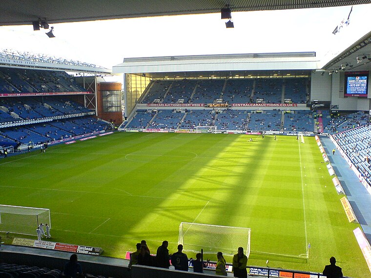
Photo: Archibald99, Public domain.
Ibrox Stadium is a football stadium on the south side of the River Clyde in the Ibrox area of Glasgow, Scotland. The home of Scottish Premiership team Rangers, Ibrox is the third-largest football stadium in Scotland, with an all-seated capacity of 51,700. Glasgow Rangers is situated 2,700 feet west of Fruit Lane.
Cessnock subway station
Metro station

Photo: Stephen Sweeney, CC BY-SA 2.0.
Cessnock subway station is a station on the Glasgow Subway that serves the eastern part of Ibrox and the Cessnock area of the city. It is also the nearest station to Festival Park.
Kelvingrove Art Gallery and Museum
Museum

Photo: 瑞丽江的河水, CC BY-SA 4.0.
Kelvingrove Art Gallery and Museum is a museum and art gallery in Glasgow, Scotland, managed by Glasgow Museums. The building is located in Kelvingrove Park in the West End of the city, adjacent to Argyle Street. Kelvingrove Art Gallery and Museum is situated 1¼ miles north of Fruit Lane.
Places in the Area
Nearby places include Cessnock and Bellahouston.
Cessnock
Suburb

Photo: Frombowen, CC BY-SA 4.0.
Cessnock is an area in the city of Glasgow, Scotland. It is situated south of the River Clyde and was part of the former Burgh of Govan. Cessnock's main street is Paisley Road West, which runs west in the direction of Paisley and east through Kinning Park to Paisley Toll.
Bellahouston
Suburb

Photo: Thomas Nugent, CC BY-SA 2.0.
Bellahouston is a district in the southwest of Glasgow. It is bordered by Dumbreck, Ibrox, Pollokshields, Craigton.
Ibrox
Suburb

Photo: Jim Smillie, CC BY-SA 2.0.
Ibrox is a suburb of Glasgow, Scotland. It is situated south of the River Clyde and is part of the former burgh of Govan. The origin of the name Ibrox is unclear: it may either derive from the Cumbric / Northern Brittonic broch or, possibly, the Gaelic àth bruic, meaning "badger ford", but this is unconfirmed.
Fruit Lane
- Type: Convenience store
- Categories: shop and food
- Location: Glasgow City, Scotland, United Kingdom, Britain and Ireland, Europe
- View on OpenStreetMap
Latitude
55.85182° or 55° 51′ 7″ northLongitude
-4.29572° or 4° 17′ 45″ westOpen location code
9C7QVP23+PPOpenStreetMap ID
node 8262367628OpenStreetMap feature
shop=convenience
This page is based on OpenStreetMap, Wikidata, and Wikimedia Commons.
We’d love your help improving our open data sources. Thank you for contributing.
Satellite Map
Discover Fruit Lane from above in high-definition satellite imagery.
Notable Places Nearby
Highlights include Gospel Hall and Bellahouston Post Office.
Nearby Places
Explore places such as forresters and Co-op Food.
Scotland: Must-Visit Destinations
Delve into Edinburgh, Glasgow, Aberdeen, and Dundee.
Curious Convenience Stores to Discover
Uncover intriguing convenience stores from every corner of the globe.
About Mapcarta. Data © OpenStreetMap contributors and available under the Open Database License". Text is available under the CC BY-SA 4.0 license, except for photos, directions, and the map. Photo: Ritchyblack, FAL.