Vanderveken-Cordemans
Vanderveken-Cordemans is a garden center in Overijse, Arrondissement Halle-Vilvoorde, Flanders. Vanderveken-Cordemans is situated nearby to the cemetery Begraafplaats Eizer, as well as near the church Maria Magdalenakerk.| Tap on a place to explore it |
Places of Interest Nearby
Highlights include Maria Magdalenakerk and Cruysboomkapel.
Maria Magdalenakerk
Church
 Maria Magdalenakerk is a church, which is situated 290 metres southeast of Vanderveken-Cordemans.
Cruysboomkapel
Church
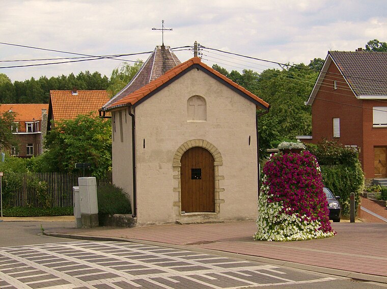
Photo: Demanvanzonien, CC BY-SA 3.0.
Cruysboomkapel is a church, which is situated 460 metres south of Vanderveken-Cordemans.
De Zuiveringsengel
Work of art

Photo: Tukka, CC BY-SA 4.0.
De Zuiveringsengel is a work of art, which is situated 530 metres west of Vanderveken-Cordemans.
Places in the Area
Nearby places include Duisburg and Tervuren.
Duisburg
Village

Photo: David Edgar, CC BY-SA 3.0.
Duisburg is a village in Flemish Brabant, Belgium. It should not be confused with the German city of Duisburg. Duisburg is a part of the municipality of Tervuren that comprises the villages of Duisburg, Tervuren, Vossem and Moorsel.
Tervuren

Photo: Lviatour, CC BY-SA 3.0.
Tervuren is a municipality in Flemish Brabant on the outskirts of the vast Sonian Forest, south-west of Brussels. It is best known as the host town of the Belgian king's summer residence, which is now the Museum for Central Africa, and for the beautiful park surrounding it.
Vossem
Village

Photo: Wikimedia, CC BY-SA 3.0.
Vossem is a sub urban residential area in the municipality of Tervuren, in Belgium, 15 km from Leuven, or Louvain. It is located in the valley of the Voer creek. Vossem is situated 4 km north of Vanderveken-Cordemans.
Vanderveken-Cordemans
- Type: Garden center
- Category: shop
- Location: Overijse, Arrondissement Halle-Vilvoorde, Flemish Brabant, Flanders, Belgium, Benelux, Europe
- View on OpenStreetMap
Latitude
50.80018° or 50° 48′ 1″ northLongitude
4.54533° or 4° 32′ 43″ eastOpen location code
9F26RG2W+34OpenStreetMap ID
node 8355664236OpenStreetMap feature
shop=garden_centre
This page is based on OpenStreetMap, Wikidata, and Wikimedia Commons.
We’d love your help improving our open data sources. Thank you for contributing.
Satellite Map
Discover Vanderveken-Cordemans from above in high-definition satellite imagery.
Notable Places Nearby
Highlights include Begraafplaats Eizer and De Fraat.
Nearby Places
Explore places such as Siki’s and Overijse Eizer Kerk.
Flemish Brabant: Must-Visit Destinations
Delve into Leuven, Kraainem, Vilvoorde, and Aarschot.
Curious Garden Centers to Discover
Uncover intriguing garden centers from every corner of the globe.
About Mapcarta. Data © OpenStreetMap contributors and available under the Open Database License". Text is available under the CC BY-SA 4.0 license, except for photos, directions, and the map. Photo: Gf uip, CC BY-SA 3.0.