Op Seibeschburren
Op Seibeschburren is a farm in Wincrange, Clervaux. Op Seibeschburren is situated nearby to the spring Source Saint-Thomas, as well as near the church Helzerklaus.| Tap on a place to explore it |
Places of Interest Nearby
Highlights include Helzerklaus and Église Saint-Eloi.
Helzerklaus
Church

Photo: Johnny Chicago, CC BY-SA 3.0.
Helzerklaus is a church, which is situated 1 km north of Op Seibeschburren.
Église Saint-Eloi
Church
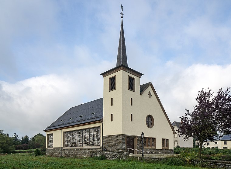
Photo: MMFE, CC BY-SA 3.0.
Église Saint-Eloi is a church, which is situated 1¼ km southeast of Op Seibeschburren.
Chapelle Saint-Aubin
Church

Photo: MMFE, CC BY-SA 3.0.
Chapelle Saint-Aubin is a church, which is situated 2½ km east of Op Seibeschburren.
Places in the Area
Nearby places include Hachiville and Hoffelt.
Hachiville
Village

Photo: Johnny Chicago, CC BY-SA 3.0.
Hachiville is a village in the commune of Wincrange, in northern Luxembourg. As of 2024, the village has a population of 206. Hachiville was a commune in the canton of Clervaux until 1 January 1978, when it was merged with the communes of Asselborn, Boevange, and Oberwampach to form the new commune of Wincrange.
Hoffelt
Village
Photo: MMFE, CC BY-SA 3.0.
Hoffelt is a small village in the commune of Wincrange, in northern Luxembourg. As of 2024, the town had a population of 381.
Weiler
Village
Photo: MMFE, CC BY-SA 3.0.
Weiler is a village, which is situated 2½ km east of Op Seibeschburren.
Op Seibeschburren
- Type: Farm
- Categories: locality and agriculture
- Location: Wincrange, Clervaux, Luxembourg, Benelux, Europe
- View on OpenStreetMap
Latitude
50.10522° or 50° 6′ 19″ northLongitude
5.90844° or 5° 54′ 30″ eastOpen location code
9F274W45+39OpenStreetMap ID
node 8488626317OpenStreetMap feature
place=farm
This page is based on OpenStreetMap, Wikidata, and Wikimedia Commons.
We’d love your help improving our open data sources. Thank you for contributing.
Satellite Map
Discover Op Seibeschburren from above in high-definition satellite imagery.
Notable Places Nearby
Highlights include Source Saint-Thomas and Mäerteskierch.
Nearby Places
Explore places such as Mathey Mazout and Shell.
Luxembourg: Must-Visit Destinations
Delve into Luxembourg, Central Luxembourg, Schengen, and Echternach.
Curious Farms to Discover
Uncover intriguing farms from every corner of the globe.
About Mapcarta. Data © OpenStreetMap contributors and available under the Open Database License". Text is available under the CC BY-SA 4.0 license, except for photos, directions, and the map. Photo: Michal Osmenda, CC BY-SA 2.0.