Hope Energy Arundel
Hope Energy Arundel is a convenience store in City of Gold Coast, Queensland which is located on Brisbane Road. Hope Energy Arundel is situated nearby to Arundel Park Riding for Disabled Inc, as well as near the park Madasin Close Reserve.| Tap on a place to explore it |
- Opening hours: 24/7
- Type: Convenience store
- Address: 440 Brisbane Road, Arundel, QLD 4214
Places of Interest Nearby
Highlights include Southport Airport and Westfield Helensvale.
Southport Airport
Aerodrome
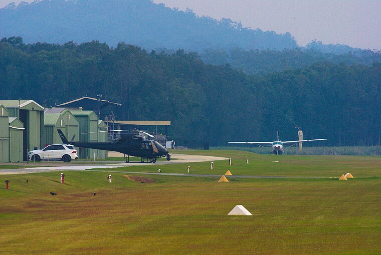
Photo: DS28, CC BY-SA 4.0.
Southport Airport is an airport located 3.5 nautical miles northwest of Southport, in Coombabah, Queensland, Australia. It is operated by the Southport Flying Club.
Westfield Helensvale
Shopping center

Photo: Shiftchange, CC0.
Westfield Helensvale is a shopping centre in Helensvale on the Gold Coast, Queensland, Australia. It opened in 2005. It was the first Westfield on the Gold Coast and includes Coles, Kmart, Aldi, Target and Woolworths as majors as well as a food court with McDonald's, KFC and Subway. Westfield Helensvale is situated 2½ km west of Hope Energy Arundel.
Helensvale railway station
Railway station

Photo: TravellerQLD, CC BY-SA 3.0.
Helensvale railway station is a major public transport interchange in the Gold Coast suburb of Helensvale. Helensvale railway station is served by the Queensland Rail Citytrain network Gold Coast line, G:link light rail and Kinetic Gold Coast bus services. Helensvale railway station is situated 2½ km west of Hope Energy Arundel.
Places in the Area
Nearby places include Northern suburbs and Southport.
Northern suburbs

Photo: Herry Lawford, CC BY 2.0.
The northern suburbs of the Gold Coast may be perhaps the most residential, but they are the most wild ones, containing many of the Gold Coast's theme parks.
Southport

Photo: Kgbo, CC BY-SA 4.0.
Southport is the central business district or business centre of the Gold Coast. Though it is the CBD of the Gold Coast, it is not as bustling as other places in the Gold Coast, and if you happen to be driving through it, there's a good chance you may not even realise you're in the CBD.
Chinatown
Neighborhood

Photo: Shiftchange, CC0.
Gold Coast Chinatown is a precinct in the Gold Coast's suburb of Southport, Queensland, Australia. It is centred on Davenport and Young Streets but also includes the connecting laneways Regent and Davison Lanes and parts of Nerang, Garden and Scarborough Streets. Chinatown is situated 7 km southeast of Hope Energy Arundel.
Hope Energy Arundel
- Categories: shop and food
- Location: City of Gold Coast, Queensland, Australia, Oceania
- View on OpenStreetMap
Latitude
-27.92777° or 27° 55′ 40″ southLongitude
153.3622° or 153° 21′ 44″ eastOperator
Hope EnergyOpen location code
5R4M39C6+VVOpenStreetMap ID
node 8873993655OpenStreetMap feature
shop=convenience
This page is based on OpenStreetMap, Wikidata, and Wikimedia Commons.
We’d love your help improving our open data sources. Thank you for contributing.
Satellite Map
Discover Hope Energy Arundel from above in high-definition satellite imagery.
Notable Places Nearby
Highlights include Arundel Park Riding for Disabled Inc and Madasin Close Reserve.
Nearby Places
Explore places such as BURGER’D and Noodle Box.
Queensland: Must-Visit Destinations
Delve into Brisbane, Gold Coast, Sunshine Coast, and Cairns.
Curious Convenience Stores to Discover
Uncover intriguing convenience stores from every corner of the globe.
About Mapcarta. Data © OpenStreetMap contributors and available under the Open Database License". Text is available under the CC BY-SA 4.0 license, except for photos, directions, and the map. Photo: Wikimedia, CC0.