Vetta sud del Montagnone
Vetta sud del Montagnone is a peak in Pietracamela, Teramo, Abruzzo and has an elevation of 1,673 metres. Vetta sud del Montagnone is situated nearby to the hamlet Pagliare di Cerchiara, as well as near the locality Vena di Fano.| Tap on a place to explore it |
Places of Interest
Highlights include Santa Maria delle Grazie and San Leucio.
Santa Maria delle Grazie
Church
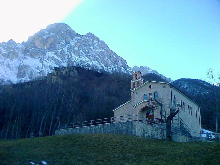
Photo: Wikimedia, Public domain.
Santa Maria delle Grazie is a church.

Places in the Area
Nearby places include Isola del Gran Sasso d’Italia and Cerchiara.
Isola del Gran Sasso d’Italia
Village

Photo: Infinitispazi, Public domain.
Isola del Gran Sasso d'Italia is a town and comune in province of Teramo in the Abruzzo region of southern Italy. It is located in the Gran Sasso e Monti della Laga National Park. The Gran Sasso mountain is the highest mountain in the Apennine chain in Italy.


Vetta sud del Montagnone
- Type: Peak with an elevation of 1,673 metres
- Category: landform
- Location: Pietracamela, Teramo, Abruzzo, Central Italy, Italy, Europe
- View on OpenStreetMap
Latitude
42.5139° or 42° 30′ 50″ northLongitude
13.5936° or 13° 35′ 37″ eastElevation
1,673 metres (5,489 feet)Open location code
8FJMGH7V+GCOpenStreetMap ID
node 8888293784OpenStreetMap feature
natural=peak
This page is based on OpenStreetMap, Wikidata, and Wikimedia Commons.
We’d love your help improving our open data sources. Thank you for contributing.
Satellite Map
Discover Vetta sud del Montagnone from above in high-definition satellite imagery.
Localities in the Area
Explore places such as Pagliare di Cerchiara and Vena di Fano.
Notable Places Nearby
Highlights include La Forchetta and Vetta Nord del Montagnone.
Teramo: Must-Visit Destinations
Delve into Teramo, Roseto degli Abruzzi, Civitella del Tronto, and Controguerra.
Curious Peaks to Discover
Uncover intriguing peaks from every corner of the globe.
About Mapcarta. Data © OpenStreetMap contributors and available under the Open Database License". Text is available under the CC BY-SA 4.0 license, except for photos, directions, and the map. Photo: corinasdavide, CC BY 3.0.