KTM
KTM is a motorcycle shop in Bauang, La Union, Ilocos. KTM is situated nearby to the place of worship Iglesia Ni Cristo - Locale of Pagdalagan, as well as near the swimming pool Ocean Breeze Resort.| Tap on a place to explore it |
Places of Interest Nearby
Highlights include San Fernando Airport.
San Fernando Airport
Aerodrome
San Fernando Airport is an airport serving the general area of San Fernando, located in the province of La Union in the Philippines. The airport is classified as a community airport by the Civil Aviation Authority of the Philippines, a body of the Department… San Fernando Airport is situated 3 km northwest of KTM.
Places in the Area
Nearby places include San Fernando and Bauang.
San Fernando
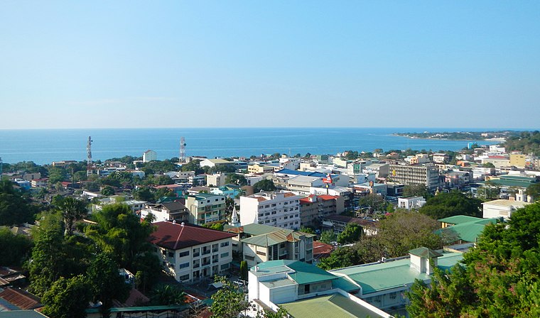
Photo: Ramon FVelaquez, CC BY-SA 3.0.
San Fernando is a city, the capital of the province of La Union in the Philippines. It is sometimes referred to with the initials of La Union's name, L.U, to distinguish it from the capital city of Pampanga of the same name.
Bauang
Town

Photo: Ramon FVelasquez, CC BY-SA 3.0.
Bauang, officially the Municipality of Bauang, is a municipality in the province of La Union, Philippines. According to the 2020 census, it has a population of 78,449. Bauang is situated 5 km south of KTM.
Naguilian
Town

Photo: Judgefloro, Public domain.
Naguilian, officially the Municipality of Naguilian, is a municipality in the province of La Union, Philippines, According to the 2020 census, it has a population of 52,189 people. Naguilian is situated 9 km southeast of KTM.
KTM
- Type: Motorcycle shop
- Category: shop
- Location: Bauang, La Union, Ilocos, Luzon, Philippines, Southeast Asia, Asia
- View on OpenStreetMap
Latitude
16.57266° or 16° 34′ 22″ northLongitude
120.32164° or 120° 19′ 18″ eastBrand
KTMOpen location code
7Q82H8FC+3MOpenStreetMap ID
node 8890647148OpenStreetMap feature
shop=motorcycle
This page is based on OpenStreetMap, Wikidata, and Wikimedia Commons.
We’d love your help improving our open data sources. Thank you for contributing.
Satellite Map
Discover KTM from above in high-definition satellite imagery.
Places with the Same Name
Discover other places named “KTM”.
Notable Places Nearby
Highlights include Iglesia Ni Cristo - Locale of Pagdalagan and Ocean Breeze Resort.
Nearby Places
Explore places such as Geckos and Golden Park Inn Hotel.
Curious Motorcycle Shops to Discover
Uncover intriguing motorcycle shops from every corner of the globe.
About Mapcarta. Data © OpenStreetMap contributors and available under the Open Database License". Text is available under the CC BY-SA 4.0 license, except for photos, directions, and the map. Photo: Wikimedia, CC0.