Complexe environnemental Saint-Michel - Centre opérationnel
Complexe environnemental Saint-Michel - Centre opérationnel is a government office in Ahuntsic-Cartierville, Montreal, Quebec which is located on Rue Michel-Jurdant. Complexe environnemental Saint-Michel - Centre opérationnel is situated nearby to the bridge Autoroute Métropolitaine, as well as near the power station Centrale électrique.| Tap on a place to explore it |
Places of Interest Nearby
Highlights include École nationale de cirque and Complexe sportif Claude-Robillard.
École nationale de cirque
College
The National Circus School is a professional circus school located in Montreal, Quebec, Canada. It is for higher education in the art of circus. The NCS also offers academic subjects at the secondary and college levels. École nationale de cirque is situated 690 metres northeast of Complexe environnemental Saint-Michel - Centre opérationnel.
Complexe sportif Claude-Robillard
Sports venue
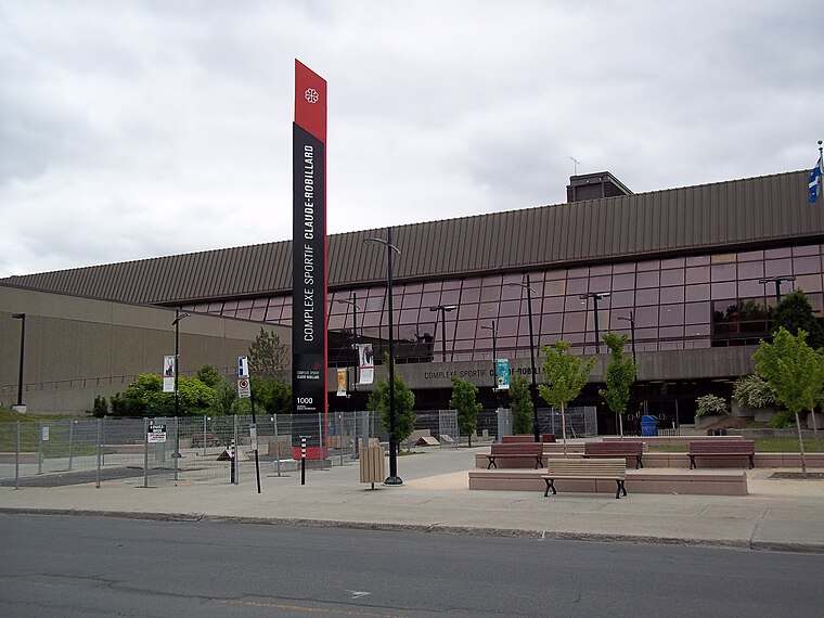
Photo: Wikimedia, CC BY-SA 3.0.
The Complexe sportif Claude-Robillard, abbreviated CSCR and often referred as Centre Claude-Robillard, is a multi-purpose sport facility, located in Montreal, Quebec, Canada, in the borough of Ahuntsic-Cartierville. Complexe sportif Claude-Robillard is situated 1¼ km southwest of Complexe environnemental Saint-Michel - Centre opérationnel.

Places in the Area
Nearby places include Rosemont–La Petite-Patrie and Sault-au-Récollet.
Rosemont–La Petite-Patrie

Photo: Jeangagnon, CC BY-SA 3.0.
Rosemont—La Petite-Patrie is an area of Montreal north of the Plateau. Unlike in many other North American cities, Montreal's Little Italy is still authentic and has not seen any tourist-oriented development.
Sault-au-Récollet
Neighborhood
Photo: Wikimedia, CC BY-SA 3.0.
Sault-au-Récollet is a neighbourhood in Montreal. It is located in the eastern edge of the borough of Ahuntsic-Cartierville, bordering the Rivière des Prairies. Sault-au-Récollet is situated 3 km west of Complexe environnemental Saint-Michel - Centre opérationnel.
Mile-End

Photo: Alain Rouiller, CC BY-SA 2.0.
Mile End, the last Mile, is a small neighborhood between Outremont, Le Plateau, Rosemont and Little Italy. The main commercial streets are parts of St-Viateur, Fairmount, Bernard, Villeneuve, Parc Ave & St-Laurent.
Complexe environnemental Saint-Michel - Centre opérationnel
- Type: Government office
- Address: 2235 Rue Michel-Jurdant, Montréal, QC
- Categories: office and government building
- Location: Ahuntsic-Cartierville, Montreal, Urban agglomeration of Montreal, Southwestern Quebec, Quebec, Canada, North America
- View on OpenStreetMap
Latitude
45.55809° or 45° 33′ 29″ northLongitude
-73.62102° or 73° 37′ 16″ westOperator
Ville de MontréalOpen location code
87Q8H95H+6HOpenStreetMap ID
node 8919493642OpenStreetMap feature
office=government
This page is based on OpenStreetMap, Wikidata, and Wikimedia Commons.
We’d love your help improving our open data sources. Thank you for contributing.
Satellite Map
Discover Complexe environnemental Saint-Michel - Centre opérationnel from above in high-definition satellite imagery.
Notable Places Nearby
Highlights include Autoroute Métropolitaine and Centrale électrique.
Nearby Places
Explore places such as Canadian Tire and Heure d’ouverture du propane.
Montreal: Must-Visit Destinations
Delve into Montreal-Pierre Elliott Trudeau International Airport, Downtown Montreal, Plateau, and Old Montreal.
Curious Government Offices to Discover
Uncover intriguing government offices from every corner of the globe.
About Mapcarta. Data © OpenStreetMap contributors and available under the Open Database License". Text is available under the CC BY-SA 4.0 license, except for photos, directions, and the map. Photo: Wikimedia, CC BY-SA 3.0.