E.Leclerc
E.Leclerc is a supermarket in Niederanven, Central Luxembourg. E.Leclerc is situated nearby to Cool Boules, as well as near the sports venue Syrdall Schwemm.| Tap on a place to explore it |
- Opening hours:
Monday—Saturday: 8:00 AM—8:00 PM
Sunday: 8:00 AM—1:00 PM - Type: Supermarket
- Wheelchair access: yes
Places of Interest Nearby
Highlights include Église de l’Assomption de la Bienheureuse-Vierge-Marie (Niederanven) and Église Saint-Jean-Baptiste (Hostert).
Église de l’Assomption de la Bienheureuse-Vierge-Marie (Niederanven)
Church
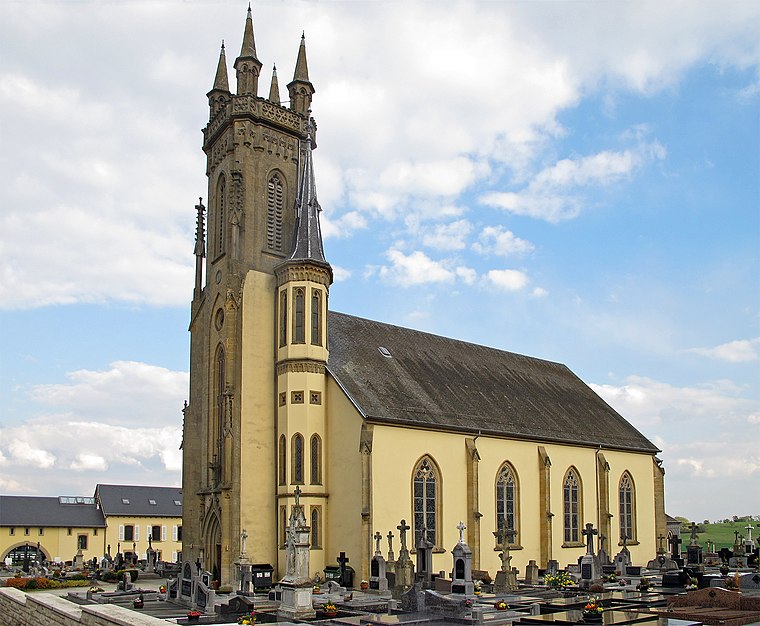
Photo: MMFE, CC BY-SA 3.0.
Église de l’Assomption de la Bienheureuse-Vierge-Marie (Niederanven) is a church, which is situated 210 metres south of E.Leclerc.
Église Saint-Jean-Baptiste (Hostert)
Church

Photo: MMFE, CC BY-SA 3.0.
Église Saint-Jean-Baptiste (Hostert) is a church, which is situated 1¼ km northwest of E.Leclerc.
Senningen Castle
Office building

Photo: Jwh, CC BY-SA 3.0 lu.
Senningen Castle is a revival-style castle, located in the town of Senningen, in the west of the commune of Niederanven, in the Grand Duchy of Luxembourg. Today it is used by the State for official meetings. Senningen Castle is situated 1 km southwest of E.Leclerc.
Places in the Area
Nearby places include Niederanven and Oberanven.
Niederanven
Village

Photo: Jwh, CC BY-SA 3.0 lu.
Niederanven is a commune in Luxembourg, located north-east of Luxembourg City, and derives its name from principal town, Niederanven. As of 2023, it has a population of 6,660.
Oberanven
Village

Photo: Johnny Chicago, CC BY-SA 3.0.
Oberanven is a small town in the commune of Niederanven, in central Luxembourg. As of 2024, the town has a population of 796. It is the administrative centre of the commune of Niederanven: new headquarters having been built in the town in 2005.
Senningen
Village

Photo: Les Meloures, CC BY-SA 3.0.
Senningen, is a small town in the commune of Niederanven, in central Luxembourg. As of 2024, the town has a population of 749.
E.Leclerc
- Categories: shop and food
- Location: Niederanven, Central Luxembourg, Luxembourg, Benelux, Europe
- View on OpenStreetMap
Latitude
49.65095° or 49° 39′ 3″ northLongitude
6.24685° or 6° 14′ 49″ eastBrand
E.LeclercOpen location code
8FX8M62W+9POpenStreetMap ID
node 897046656OpenStreetMap feature
shop=supermarketOpenStreetMap attribute
wheelchair=yes
This page is based on OpenStreetMap, Wikidata, and Wikimedia Commons.
We’d love your help improving our open data sources. Thank you for contributing.
Satellite Map
Discover E.Leclerc from above in high-definition satellite imagery.
Places with the Same Name
Discover other places named “E.Leclerc”.
Notable Places Nearby
Highlights include Cool Boules and Syrdall Schwemm.
Nearby Places
Explore places such as Centre Commercial Les Arcades and Fischer.
Curious Supermarkets to Discover
Uncover intriguing supermarkets from every corner of the globe.
About Mapcarta. Data © OpenStreetMap contributors and available under the Open Database License". Text is available under the CC BY-SA 4.0 license, except for photos, directions, and the map. Photo: MMFE, CC BY-SA 4.0.