Slumdog
Slumdog is a fast food restaurant in Edinburgh, Scotland. Slumdog is situated nearby to the church St Mary’s Cathedral, as well as near St Andrew’s Hall.| Tap on a place to explore it |
Places of Interest Nearby
Highlights include St Mary’s Cathedral and Calton Hill.
St Mary’s Cathedral
Church

Photo: AdMeskens, CC BY-SA 3.0.
The Metropolitan Cathedral of Our Lady of the Assumption, also known as St Mary's Metropolitan Cathedral, is a Roman Catholic church in Edinburgh, Scotland.
Calton Hill
Park

Photo: 瑞丽江的河水, CC BY-SA 4.0.
Calton Hill is a hill in central Edinburgh, Scotland, situated beyond the east end of Princes Street and included in the city's UNESCO World Heritage Site. Calton Hill is situated 1,100 feet east of Slumdog.
Edinburgh Castle
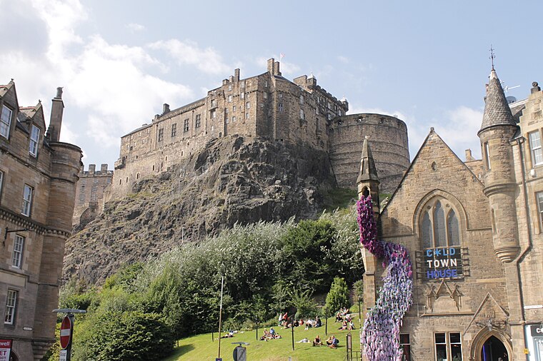
Photo: Stephencdickson, CC BY-SA 4.0.
Edinburgh Castle is a historic castle in Edinburgh, Scotland. It stands on Castle Rock, which has been occupied by humans since at least the Iron Age. There has been a royal castle on the rock since the reign of Malcolm III in the 11th century, and the castle continued to be a royal residence until 1633. Edinburgh Castle is situated 3,600 feet southwest of Slumdog.
Places in the Area
Nearby places include Broughton and Bellevue.
Broughton
Suburb

Photo: Kim Traynor, CC BY-SA 3.0.
Broughton is an area of Edinburgh, Scotland. Broughton was an ancient feudal barony that existed outside of Edinburgh before it was later incorporated into the city as urban development took place in the 18th and 19th centuries.
Bellevue
Neighborhood
Bellevue is a district of Edinburgh, the capital of Scotland. It lies to the south east of Canonmills, west of Leith Walk and south of Leith, incorporating the easternmost extent of Edinburgh's New Town UNESCO heritage site.
New Town

Photo: AlasdairW, CC BY-SA 3.0.
New Town of Edinburgh is 250 years old, in contrast to the Old Town settled for over a thousand years. It was laid out on a grid pattern in the late 18th century with elegant Georgian townhouses, and the intervening loch was drained to become Princes Street Gardens.
Slumdog
- Type: Fast food restaurant
- Cuisine: Indian
- Categories: building, kiosk, food, and restaurant
- Location: Edinburgh, Scotland, United Kingdom, Britain and Ireland, Europe
- View on OpenStreetMap
Latitude
55.95565° or 55° 57′ 20″ northLongitude
-3.18761° or 3° 11′ 15″ westOpen location code
9C7RXR46+7XOpenStreetMap ID
node 9162681509OpenStreetMap feature
amenity=fast_foodOpenStreetMap feature
building=kioskOpenStreetMap attribute
cuisine=indian
This page is based on OpenStreetMap, Wikidata, and Wikimedia Commons.
We’d love your help improving our open data sources. Thank you for contributing.
Satellite Map
Discover Slumdog from above in high-definition satellite imagery.
Places with the Same Name
Discover other places named “Slumdog”.
Notable Places Nearby
Highlights include St Andrew’s Hall and Everyman.
Nearby Places
Explore places such as Pizza Geeks and La Zeez.
Edinburgh: Must-Visit Destinations
Delve into Old Town, New Town, West Edinburgh, and Leith.
Curious Fast Food Restaurants to Discover
Uncover intriguing fast food restaurants from every corner of the globe.
About Mapcarta. Data © OpenStreetMap contributors and available under the Open Database License". Text is available under the CC BY-SA 4.0 license, except for photos, directions, and the map. Photo: Wikimedia, CC BY 3.0.