Snow Pass
Snow Pass is a mountain saddle in Madera County, San Joaquin Valley, California and has an elevation of 11,211 feet. Snow Pass is situated nearby to the locality Moraine Meadows.| Tap on a place to explore it |
Places of Interest
Highlights include Merced Peak and Triple Divide Peak.
Merced Peak
Peak
Merced Peak, with an elevation of 11,731 feet, is the highest point in the Clark Range, just surpassing three other peaks; Red Peak, Gray Peak, and Mount Clark.
Triple Divide Peak
Peak
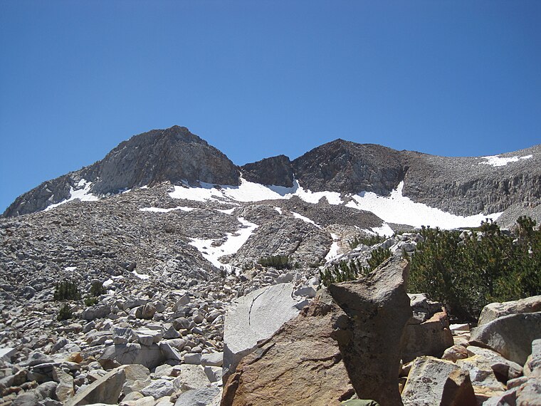
Photo: LizardWizard, CC BY-SA 3.0.
Triple Divide Peak is a mountain on the boundary between Yosemite National Park and the Ansel Adams Wilderness in Madera County, California. It is located 0.7 miles north of Walton Lake and 1.3 miles southeast of Merced Peak.
Red Peak
Peak
Red Peak is an 11,699-foot-elevation mountain summit located in the Sierra Nevada mountain range, in Madera County of northern California, United States.
Snow Pass
- Type: Mountain saddle with an elevation of 11,211 feet
- Category: landform
- Location: Madera County, San Joaquin Valley, California, United States, North America
- View on OpenStreetMap
Latitude
37.6379° or 37° 38′ 16″ northLongitude
-119.3923° or 119° 23′ 33″ westElevation
11,211 feet (3,417 metres)Open location code
8592JJQ5+43OpenStreetMap ID
node 9174550049OpenStreetMap feature
natural=saddle
This page is based on OpenStreetMap, Wikidata, and Wikimedia Commons.
We’d love your help improving our open data sources. Thank you for contributing.
Satellite Map
Discover Snow Pass from above in high-definition satellite imagery.
Places with the Same Name
Discover other places named “Snow Pass”.
Localities in the Area
Explore places such as Moraine Meadows and Happy Isles.
Notable Places Nearby
Highlights include Ottoway Peak and Merced Peak Ridge.
Madera County: Must-Visit Destinations
Delve into Madera, Chowchilla, Oakhurst, and Coarsegold.
Curious Mountain Saddles to Discover
Uncover intriguing mountain saddles from every corner of the globe.
About Mapcarta. Data © OpenStreetMap contributors and available under the Open Database License". Text is available under the CC BY-SA 4.0 license, except for photos, directions, and the map. Photo: Wikimedia, CC0.