Bruntshiel Hill
Bruntshiel Hill is a peak in Dumfries and Galloway, South West, Scotland and has an elevation of 837 feet. Bruntshiel Hill is situated nearby to the locality Bog Craigs, as well as near Mungo’s Faulds.| Tap on a place to explore it |
Places of Interest
Highlights include Langholm Distillery.

Places in the Area
Nearby places include Langholm and Rowanburn.
Langholm
Town
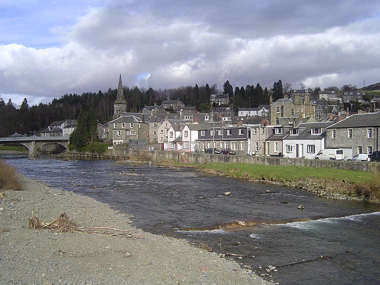
Photo: Robma, CC BY-SA 3.0.
Langholm, also known colloquially as the "Muckle Toon", is a burgh in Dumfries and Galloway, southern Scotland. Langholm lies between four hills in the valley of the River Esk in the Southern Uplands.
Rowanburn
Village

Photo: Brian Bailey, CC BY-SA 2.0.
Rowanburn is a hamlet in Eskdale, Dumfries and Galloway, Scotland. Located near Canonbie, it sits around 5 miles south-east of Langholm and about a mile from the Anglo-Scottish border.
Kershopefoot
Hamlet

Photo: Brian Bailey, CC BY-SA 2.0.
Kershopefoot is a small hamlet in Cumbria, England, traditionally in Cumberland. It is located very close to the Scotland-England border and is near the Kershope Burn and the Liddel Water.
Bruntshiel Hill
- Type: Peak with an elevation of 837 feet
- Category: landform
- Location: Dumfries and Galloway, South West, Scotland, United Kingdom, Britain and Ireland, Europe
- View on OpenStreetMap
Latitude
55.1343° or 55° 8′ 4″ northLongitude
-2.9226° or 2° 55′ 21″ westElevation
837 feet (255 metres)Open location code
9C7V43MG+PXOpenStreetMap ID
node 9215759500OpenStreetMap feature
natural=peak
This page is based on OpenStreetMap, Wikidata, and Wikimedia Commons.
We’d love your help improving our open data sources. Thank you for contributing.
Satellite Map
Discover Bruntshiel Hill from above in high-definition satellite imagery.
Localities in the Area
Explore places such as Bog Craigs and Mungo’s Faulds.
Notable Places Nearby
Highlights include Tinnisburn Forest and Bruntshiel Bog Plantation.
Dumfries and Galloway: Must-Visit Destinations
Delve into Dumfries, Lockerbie, Stranraer, and Gretna.
Curious Peaks to Discover
Uncover intriguing peaks from every corner of the globe.
About Mapcarta. Data © OpenStreetMap contributors and available under the Open Database License". Text is available under the CC BY-SA 4.0 license, except for photos, directions, and the map. Photo: Phil Sangwell, CC BY 2.0.