Over Wray
Over Wray is a locality in Dumfries and Galloway, South West, Scotland. Over Wray is situated nearby to the locality Wrae, as well as near Wray Hass.| Tap on a place to explore it |
Places of Interest
Highlights include Erskine Church, Townhead, Langholm and Townhead House, 11 High Street, Langholm.
Erskine Church, Townhead, Langholm
Church

Photo: Victuallers, CC BY-SA 4.0.
Erskine Church, Townhead, Langholm is situated 2½ miles south of Over Wray.
Townhead House, 11 High Street, Langholm
Building

Photo: Victuallers, CC BY-SA 4.0.
Townhead House, 11 High Street, Langholm is a building, which is situated 2½ miles south of Over Wray.
Places in the Area
Nearby places include Arkleton and Langholm.
Arkleton
Village

Photo: RusticaUK, CC BY-SA 3.0.
Arkleton is a mansion and estate in the civil parish of Ewes, in Dumfries and Galloway, Scotland. Arkleton House was built in 1860/1884 and incorporates stone from Arkleton tower which stood nearby for 300 years until the early 19th Century. Arkleton is situated 2 miles north of Over Wray.
Langholm
Town
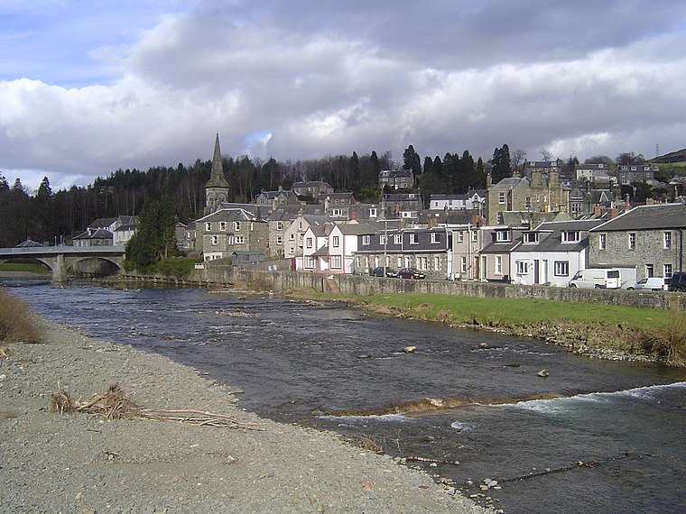
Photo: Robma, CC BY-SA 3.0.
Langholm, also known colloquially as the "Muckle Toon", is a burgh in Dumfries and Galloway, southern Scotland. Langholm lies between four hills in the valley of the River Esk in the Southern Uplands. Langholm is situated 2½ miles south of Over Wray.
Bentpath
Village

Photo: Kevin Rae, CC BY-SA 2.0.
Bentpath is a small village between Eskdalemuir and Langholm in Dumfries and Galloway, Scotland. It is located on the River Esk and has a church and a library. Westerkirk library was founded in 1791 and is the oldest library in Scotland which is still in use. Bentpath is situated 3½ miles west of Over Wray.
Over Wray
- Type: Locality
- Location: Dumfries and Galloway, South West, Scotland, United Kingdom, Britain and Ireland, Europe
- View on OpenStreetMap
Latitude
55.18735° or 55° 11′ 15″ northLongitude
-2.99366° or 2° 59′ 37″ westOpen location code
9C7V52P4+WGOpenStreetMap ID
node 9311857594OpenStreetMap feature
place=locality
This page is based on OpenStreetMap, Wikidata, and Wikimedia Commons.
We’d love your help improving our open data sources. Thank you for contributing.
Satellite Map
Discover Over Wray from above in high-definition satellite imagery.
Localities in the Area
Explore places such as Wrae and Wray Hass.
Notable Places Nearby
Highlights include Flask Wood and Wrae Hill.
Dumfries and Galloway: Must-Visit Destinations
Delve into Dumfries, Lockerbie, Stranraer, and Gretna.
Curious Localities to Discover
Uncover intriguing localities from every corner of the globe.
About Mapcarta. Data © OpenStreetMap contributors and available under the Open Database License". Text is available under the CC BY-SA 4.0 license, except for photos, directions, and the map. Photo: Phil Sangwell, CC BY 2.0.