Bric Crociere
Bric Crociere is a locality in Asti, Langhe, Piedmont. Bric Crociere is situated nearby to the locality Bric Lupi, as well as near I Crotin.| Tap on a place to explore it |
Places of Interest
Highlights include Serravalle d’Asti railway halt and Chiesa di San Giovanni Battista.
Serravalle d’Asti railway halt
Railway stop

Photo: Wikimedia, CC BY-SA 3.0.
Serravalle d’Asti railway halt is a railway stop.
Chiesa di San Giovanni Battista
Church

Photo: NicoloRizzetto, CC BY-SA 4.0.
Chiesa di San Giovanni Battista is a church.
Chiesa di San Giuseppe a Sessant
Church

Photo: Neq00, CC BY-SA 4.0.
Chiesa di San Giuseppe a Sessant is a church.
Places in the Area
Nearby places include Callianetto and Sessant.
Callianetto
Hamlet
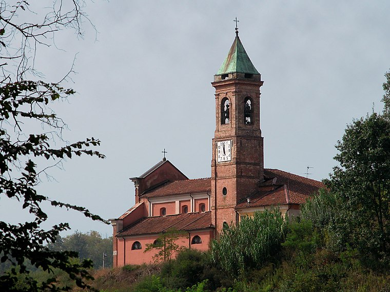
Photo: Witchblue, CC BY-SA 3.0.
Callianetto is a hamlet, which is situated 2½ km northeast of Bric Crociere.
Sessant
Village
Photo: Neq00, CC BY-SA 4.0.
Sessant is a village, which is situated 3 km south of Bric Crociere.
Viatosto
Hamlet

Photo: Phyrexian, CC BY-SA 4.0.
Viatosto is a hamlet, which is situated 4 km southeast of Bric Crociere.
Bric Crociere
- Type: Locality
- Location: Asti, Province of Asti, Langhe, Piedmont, Northwest Italy, Italy, Europe
- View on OpenStreetMap
Latitude
44.95532° or 44° 57′ 19″ northLongitude
8.16407° or 8° 9′ 51″ eastOpen location code
8FPCX547+4JOpenStreetMap ID
node 9518751532OpenStreetMap feature
place=locality
This page is based on OpenStreetMap, Wikidata, and Wikimedia Commons.
We’d love your help improving our open data sources. Thank you for contributing.
Satellite Map
Discover Bric Crociere from above in high-definition satellite imagery.
Localities in the Area
Explore places such as Bric Lupi and I Crotin.
Notable Places Nearby
Highlights include Villavecchia and Serravalle d’Asti.
Curious Localities to Discover
Uncover intriguing localities from every corner of the globe.
About Mapcarta. Data © OpenStreetMap contributors and available under the Open Database License". Text is available under the CC BY-SA 4.0 license, except for photos, directions, and the map. Photo: Alberto.domanda, CC BY-SA 3.0.