Teviotdale Avenue
Teviotdale Avenue is a bus stop in Dundee City, Scotland. Teviotdale Avenue is situated nearby to the post office Downfield Mini Mart, as well as near Ss Leonard & Fergus Church.| Tap on a place to explore it |
Places of Interest Nearby
Highlights include Baldragon Academy and King’s Cross Hospital.
Baldragon Academy
School
Baldragon Academy is a six-year comprehensive in the Kirkton area of the city of Dundee, Scotland. It was originally named Kirkton High School until merging with Rockwell High School in August 1997. Baldragon Academy is situated 3,100 feet northeast of Teviotdale Avenue.
King’s Cross Hospital
Hospital

Photo: Wikimedia, Public domain.
King's Cross Hospital, often shortened to King's Cross is a hospital in Dundee, Scotland. It is managed by NHS Tayside. King’s Cross Hospital is situated 1 mile southeast of Teviotdale Avenue.
Dundee Ice Arena
Ice rink
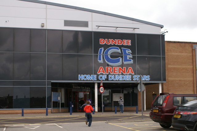
Photo: Mike Pennington, CC BY-SA 2.0.
Dundee Ice Arena, a multifaceted ice rink facility, is situated in the Camperdown locality of Dundee, Scotland. Boasting a seating capacity of 2,400, it ranks as the fourth largest ice rink in Scotland, surpassed only by Braehead Arena, Murrayfield Ice Rink, and Fife Ice Arena. Dundee Ice Arena is situated 1¼ miles southwest of Teviotdale Avenue.
Places in the Area
Nearby places include Downfield and Balgowan.
Downfield
Suburb
Downfield is a residential area located in the north of Dundee, Scotland, centred on the stretch of the Strathmartine Road between the Kingsway and the northern boundary of Dundee.
Balgowan
Suburb
Balgowan is an area of Dundee, Scotland. The name derives from the Scottish Gaelic Baile Ghobhainn, meaning "blacksmith's stead".
St Marys
Suburb
St Mary's is in a residential area of Dundee located in the extreme northwest of the city, to the north of Ardler and west of Kirkton. It is also bounded on the west by Downfield Golf Club, to the northwest by Clatto Country Park and to the north by Craigowl View.
Teviotdale Avenue
- Type: Bus stop
- Category: transportation
- Location: Dundee City, Scotland, United Kingdom, Britain and Ireland, Europe
- View on OpenStreetMap
Latitude
56.49118° or 56° 29′ 28″ northLongitude
-3.00086° or 3° 0′ 3″ westOpen location code
9C8RFXRX+FMOpenStreetMap ID
node 9779042077OpenStreetMap feature
highway=bus_stopOpenStreetMap feature
public_transport=platform
This page is based on OpenStreetMap, Wikidata, and Wikimedia Commons.
We’d love your help improving our open data sources. Thank you for contributing.
Satellite Map
Discover Teviotdale Avenue from above in high-definition satellite imagery.
Notable Places Nearby
Highlights include Downfield Mini Mart and Ss Leonard & Fergus Church.
Nearby Places
Explore places such as Teviotdale Avenue and Nithsdale Avenue.
Scotland: Must-Visit Destinations
Delve into Edinburgh, Glasgow, Aberdeen, and Dundee.
Curious Bus Stops to Discover
Uncover intriguing bus stops from every corner of the globe.
About Mapcarta. Data © OpenStreetMap contributors and available under the Open Database License". Text is available under the CC BY-SA 4.0 license, except for photos, directions, and the map. Photo: Ritchyblack, FAL.