Het Vossenpad
Het Vossenpad is in Barendrecht Municipality, South Holland. Het Vossenpad is situated nearby to the hamlet Koedood, as well as near Havenhoofd.| Tap on a place to explore it |
Places of Interest Nearby
Highlights include Portlandsebrug and Protestant Cemetery Charlois.
Portlandsebrug
Bridge
The Portlandsebrug, known as the Netkous, is a bicycle and pedestrian bridge in Rotterdam and Albrandswaard crossing the A15 motorway and connects Rotterdam-Charlois with Rhoon. Portlandsebrug is situated 2½ km northwest of Het Vossenpad.
Protestant Cemetery Charlois
Cemetery
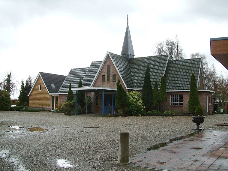
Photo: Wikimedia, CC BY-SA 3.0.
Protestant Cemetery Charlois is situated 2½ km northwest of Het Vossenpad.
Bethelkerk
Church

Photo: Wikimedia, Public domain.
Bethelkerk is a church, which is situated 3 km north of Het Vossenpad.
Places in the Area
Nearby places include Koedood and Smitshoek.
Koedood
Hamlet
Koedood is a hamlet in the Dutch province of South Holland. It is located on the border of the municipalities of Albrandswaard and Barendrecht. Koedood was the name of a small stream, flowing from the Oude Maas northwest to the Nieuwe Maas, opposite of Schiedam.

Heinenoord
Village
Heinenoord is a village in the Dutch province of South Holland on the island Hoekse Waard. It is located about 10 km south of Rotterdam, in the municipality of Hoeksche Waard.
Het Vossenpad
- Type: Sign
- Categories: information and tourism
- Location: Barendrecht Municipality, South Holland, Western Netherlands, Netherlands, Benelux, Europe
- View on OpenStreetMap
Latitude
51.84374° or 51° 50′ 38″ northLongitude
4.48895° or 4° 29′ 20″ eastNetwork
Het VossenpadOpen location code
9F36RFVQ+FHOpenStreetMap ID
node 9839464679OpenStreetMap feature
tourism=information
This page is based on OpenStreetMap, Wikidata, and Wikimedia Commons.
We’d love your help improving our open data sources. Thank you for contributing.
Satellite Map
Discover Het Vossenpad from above in high-definition satellite imagery.
Notable Places Nearby
Highlights include Havenhoofd and Carnisse Grienden.
Nearby Places
Explore places such as Minibieb De Ekelenburg and Gaatkensplas: ‘duikers’ en vondsten.
South Holland: Must-Visit Destinations
Delve into Rotterdam, The Hague, Leiden, and Delft.
Curious Places to Discover
Uncover intriguing places from every corner of the globe.
About Mapcarta. Data © OpenStreetMap contributors and available under the Open Database License". Text is available under the CC BY-SA 4.0 license, except for photos, directions, and the map. Photo: Globe-trotter, CC BY-SA 2.0.