BP
BP is a gas station in South Lanarkshire, Scotland. BP is situated nearby to Gallowflat Street, as well as near Rutherglen Post Office.| Tap on a place to explore it |
Places of Interest Nearby
Highlights include Rutherglen Town Hall and Rutherglen railway station.
Rutherglen Town Hall
Town hall

Photo: BrainiacBlink, CC BY-SA 4.0.
Rutherglen Town Hall is a municipal facility on the north side of Main Street in Rutherglen, Scotland. The town hall, which was the headquarters of Rutherglen Burgh Council, is a Category A listed building. Rutherglen Town Hall is situated 1,200 feet west of BP.
Rutherglen railway station
Railway station

Photo: BrainiacBlink, CC BY-SA 4.0.
Rutherglen railway station is in the town centre of Rutherglen, South Lanarkshire, Scotland, and lies on the Argyle Line. The station is served by a single island platform, connected to the street by a footbridge. Rutherglen railway station is situated 1,500 feet northwest of BP.
Rutherglen Library
Library

Photo: Crowsus, CC BY-SA 4.0.
Rutherglen Library is situated 1,000 feet west of BP.
Places in the Area
Nearby places include Rutherglen and Eastfield.
Rutherglen
Town
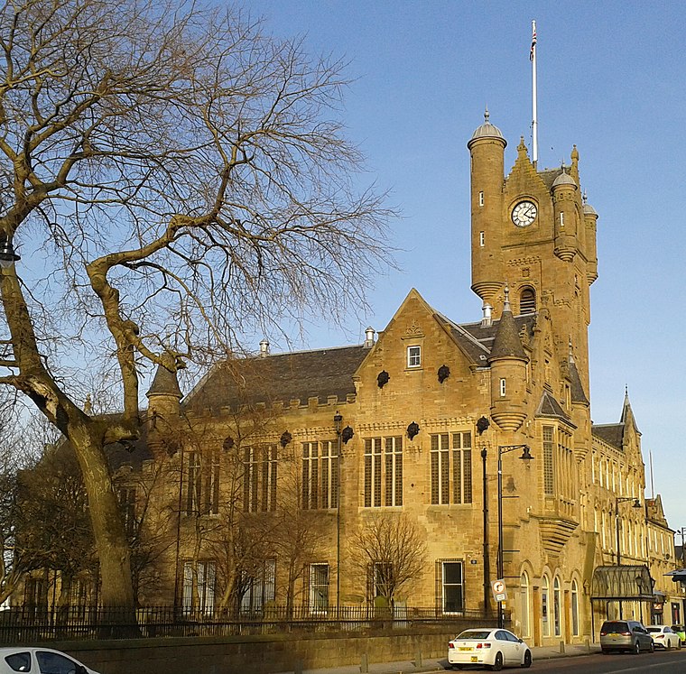
Photo: BrainiacBlink, CC BY-SA 4.0.
Glasgow is the largest city in Scotland on Clydeside in the Central Belt. Glasgow reinvented itself from the 1990s, one of the most successful examples in Britain, with a range of developments in industry, culture, cuisine and architecture.
Eastfield
Suburb
Eastfield is a mainly residential district in South Lanarkshire, Scotland, located between the industrial towns of Rutherglen and Cambuslang in the south-east of the Greater Glasgow urban area.
Shawfield
Suburb
Shawfield is an industrial/commercial area of the Royal Burgh of Rutherglen in South Lanarkshire, Scotland, located to the north of the town centre. It is bordered to the east by the River Clyde, to the north by the Glasgow neighbourhood of Oatlands and the…
BP
- Type: Gas station
- Category: transportation
- Location: South Lanarkshire, Scotland, United Kingdom, Britain and Ireland, Europe
- View on OpenStreetMap
Latitude
55.82857° or 55° 49′ 43″ northLongitude
-4.20856° or 4° 12′ 31″ westBrand
BPOpen location code
9C7QRQHR+CHOpenStreetMap ID
node 9878962095OpenStreetMap feature
amenity=fuel
This page is based on OpenStreetMap, Wikidata, and Wikimedia Commons.
We’d love your help improving our open data sources. Thank you for contributing.
Satellite Map
Discover BP from above in high-definition satellite imagery.
Notable Places Nearby
Highlights include Gallowflat Street and Rutherglen Post Office.
Nearby Places
Explore places such as Caledonia Aenue and King Street.
Scotland: Must-Visit Destinations
Delve into Edinburgh, Glasgow, Aberdeen, and Dundee.
Curious Gas Stations to Discover
Uncover intriguing gas stations from every corner of the globe.
About Mapcarta. Data © OpenStreetMap contributors and available under the Open Database License". Text is available under the CC BY-SA 4.0 license, except for photos, directions, and the map. Photo: Ritchyblack, FAL.