Cındallı
Cındallı is a neighborhood in Aybastı İlçesi, Ordu. Cındallı is situated nearby to the neighborhood Oğuz Beli, as well as near Arpacılar.| Tap on a place to explore it |
Places in the Area
Nearby places include Aybasti and Kabataş.
Aybasti
Town
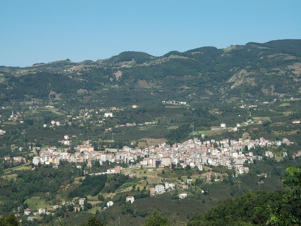 Aybastı is a municipality and district of Ordu Province, Turkey. Its area is 250 km2, and its population is 20,969. The town lies at an elevation of 764 m. Aybasti is situated 5 km west of Cındallı.
Kabataş
Town
Kabataş, formerly Karay, is a municipality and district of Ordu Province, Turkey. Its area is 74 km2, and its population is 10,119. The town lies at an elevation of 450 m. Kabataş is situated 8 km north of Cındallı.
Alankent
Suburb
Alankent is a neighbourhood of the municipality and district of Kabataş, Ordu Province, Turkey. Its population is 454. Before the 2013 reorganisation, it was a town. Alankent is situated 9 km northwest of Cındallı.
Cındallı
- Type: Neighborhood
- Category: locality
- Location: Aybastı İlçesi, Ordu, Turkey, Middle East, Asia
- View on OpenStreetMap
Latitude
40.68255° or 40° 40′ 57″ northLongitude
37.46351° or 37° 27′ 49″ eastOpen location code
8GGVMFM7+2COpenStreetMap ID
node 9931811794OpenStreetMap feature
place=neighbourhood
This page is based on OpenStreetMap, Wikidata, and Wikimedia Commons.
We’d love your help improving our open data sources. Thank you for contributing.
Satellite Map
Discover Cındallı from above in high-definition satellite imagery.
Localities in the Area
Explore places such as Oğuz Beli and Arpacılar.
Notable Places Nearby
Highlights include Hisarcık Yukarı Yeni Camii and Hisarcık Aşağı Camiii.
Turkey: Must-Visit Destinations
Delve into Istanbul, Edirne, Ankara, and Izmir.
Curious Neighborhoods to Discover
Uncover intriguing neighborhoods from every corner of the globe.
About Mapcarta. Data © OpenStreetMap contributors and available under the Open Database License". Text is available under the CC BY-SA 4.0 license, except for photos, directions, and the map. Photo: Moonik, CC BY-SA 3.0.